Shetland

The Shetland Islands: A 10 Day Itinerary

IMG_3524.jpeg

Before our 10 day adventure to the Shetland Islands, I spent months researching, reading and watching YouTube channels about Shetland so that I could decide how to spend our time on the island. Honestly, this was almost the best part!

A few beliefs guided me:

  1. Travel is better when you go deep. We could have tried to do all of Scotland, or added Orkney or added highlights in England, Wales, Scotland, and Shetland in two weeks. But what I find is that when you try to skim over places instead of going deep, the experience ends up feeling like drinking skim milk. You’re just not satisfied at the end. I wanted to go deep with Shetland, to really experience what I could with the place, and I encourage you to do the same.

  2. Travel is better when you plan it yourself and go alone (or as a couple). Now listen, I know the majority of travelers do not venture alone. They go on a cruise, or a bus tour, or with a group and a guide of some sort. They do that because it saves time in the planning stages. Plus they have an instant guide. It feels safer. It may even be cheaper. Those are good reasons. However, it’s not an adventure if everything feels safe (like Disneyland) and it only becomes an adventure if something terrible happens and you survive it (think Titanic). Travel is a great way to grow, and you won’t grow if you stay in your comfort zone, so do it alone if you can or with a partner or a friend so you can grow!

  3. Travel is better when you learn something while you’re there. Here’s the thing. If you just want to go drink a cocktail on a beach somewhere, that is okay. We Americans spend way too much time working and as a result a lot of us are burnt out and just need a mental vacation for a while. However, travel can be so much more fun if you decide you’re going to use it not only to take a break, but to learn something new. Your brain will thank you for it. Decide you want to know something about the place (every place has a history), its culture, its wildlife, its architecture, its food, its language, its people. Once you know more about what you really want to learn about that will help guide the planning of your trip.

With that said, here is a suggested 10-Day itinerary for the Shetland Islands based on our latest experience, and what we would like to do when we go again (which I hope is soon).

Day 1: Fly into Sumburgh, explore Sumburgh Head

Shetland has three airports, but the main airport is at the very southern tip of the island. It’s easy to get in and out of because it’s tiny, and there is a nice restaurant in the airport.

We arrived from a connector flight from Inverness, Scotland. You can take a ferry and it will be less expensive, but it will add 12 hours to your trip. The flight from Scotland is only an hour, that’s why I recommend the flight. When you have limited time, it’s worth the money to fly.

Check in at the Sumburgh Hotel, just a five minute drive from the airport. Make sure and get reservations at the hotel for dinner. The food is excellent and there is nowhere else to eat nearby.

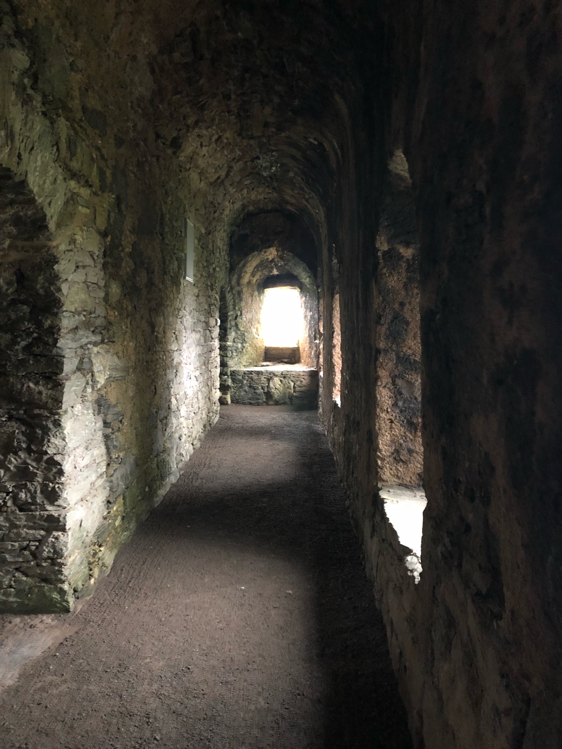
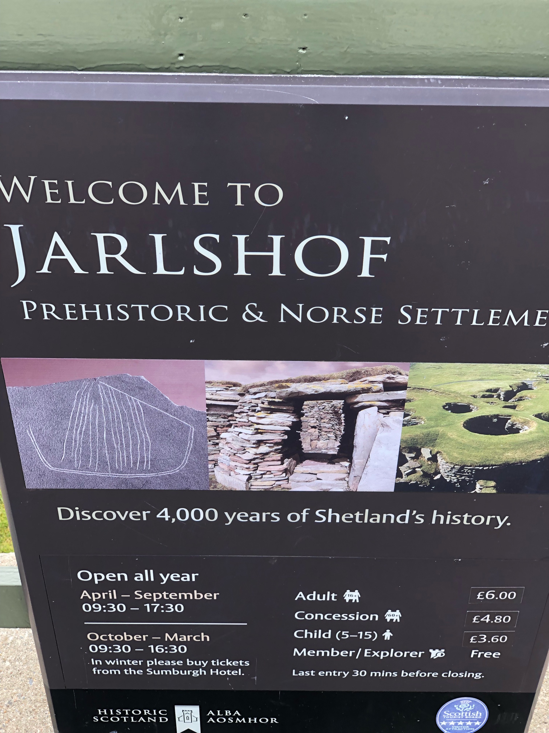
At the hotel doorstep is one of the finest archaeological sites in Shetland, called Jarlshof. Budget about an hour to fully explore the ruins of centuries, take photos of the Shetland ponies nearby, and learn about the ancient history of the island.

Then drive the one lane road up to the Sumburgh Head Lighthouse, and look for puffins and other rare sea birds.

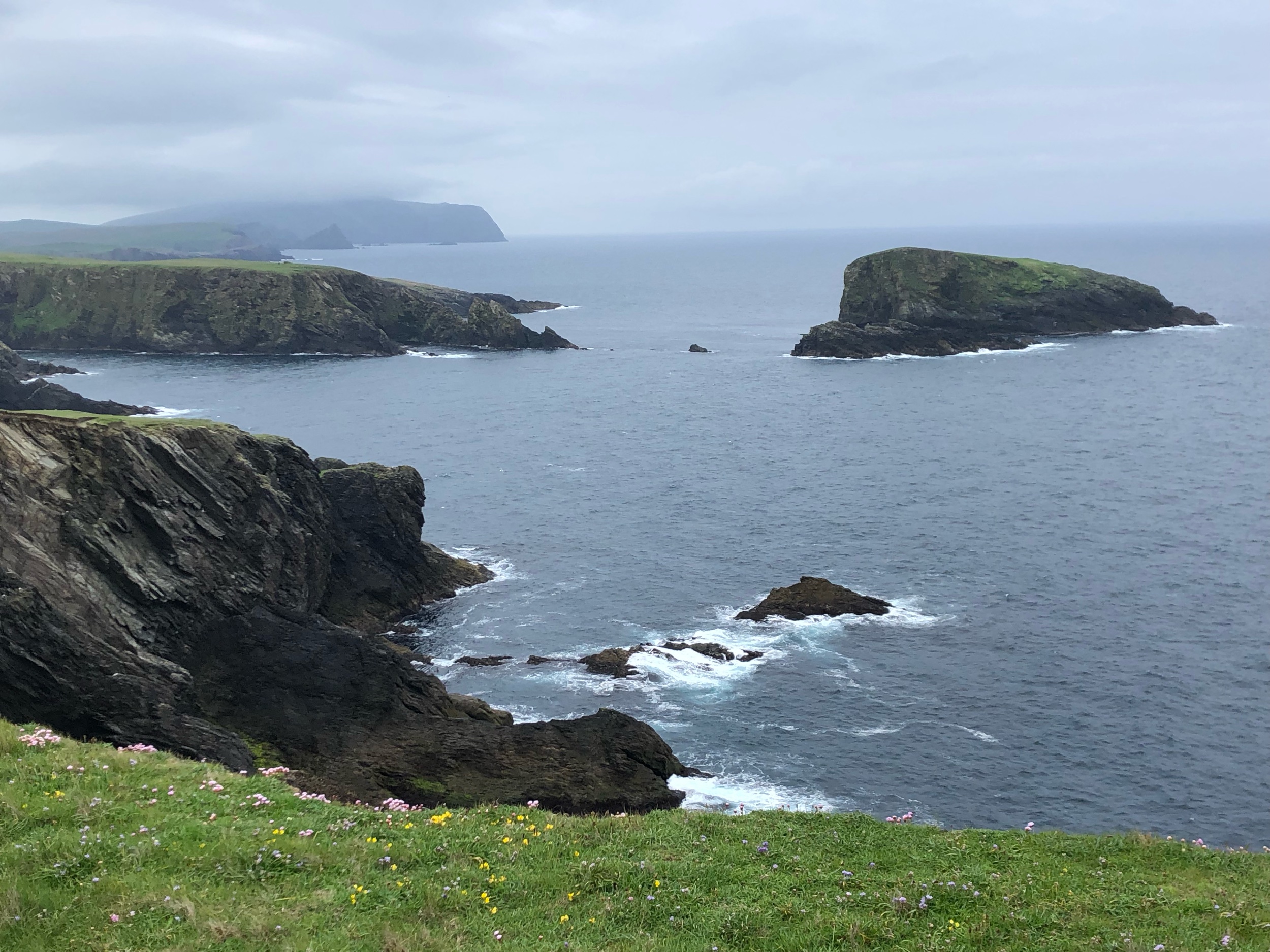
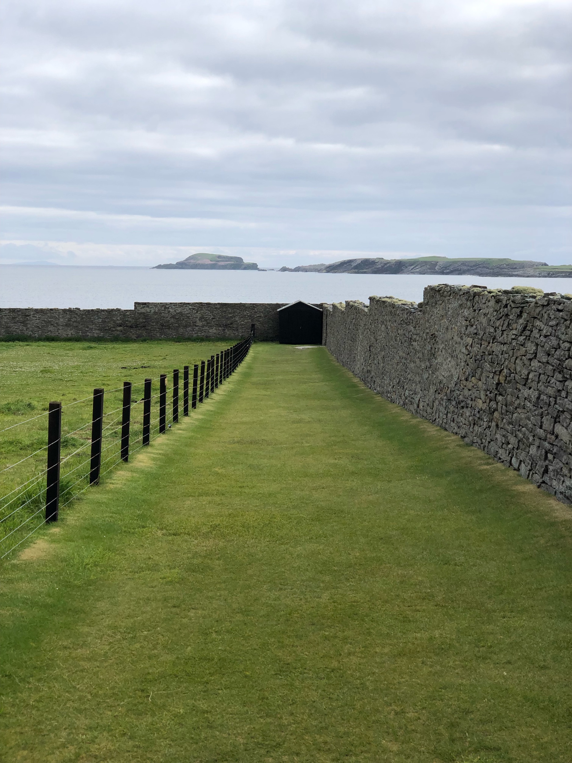
Finally, end your day with a short walk around the Ness of Birgi to the remains of an Iron Age settlement.

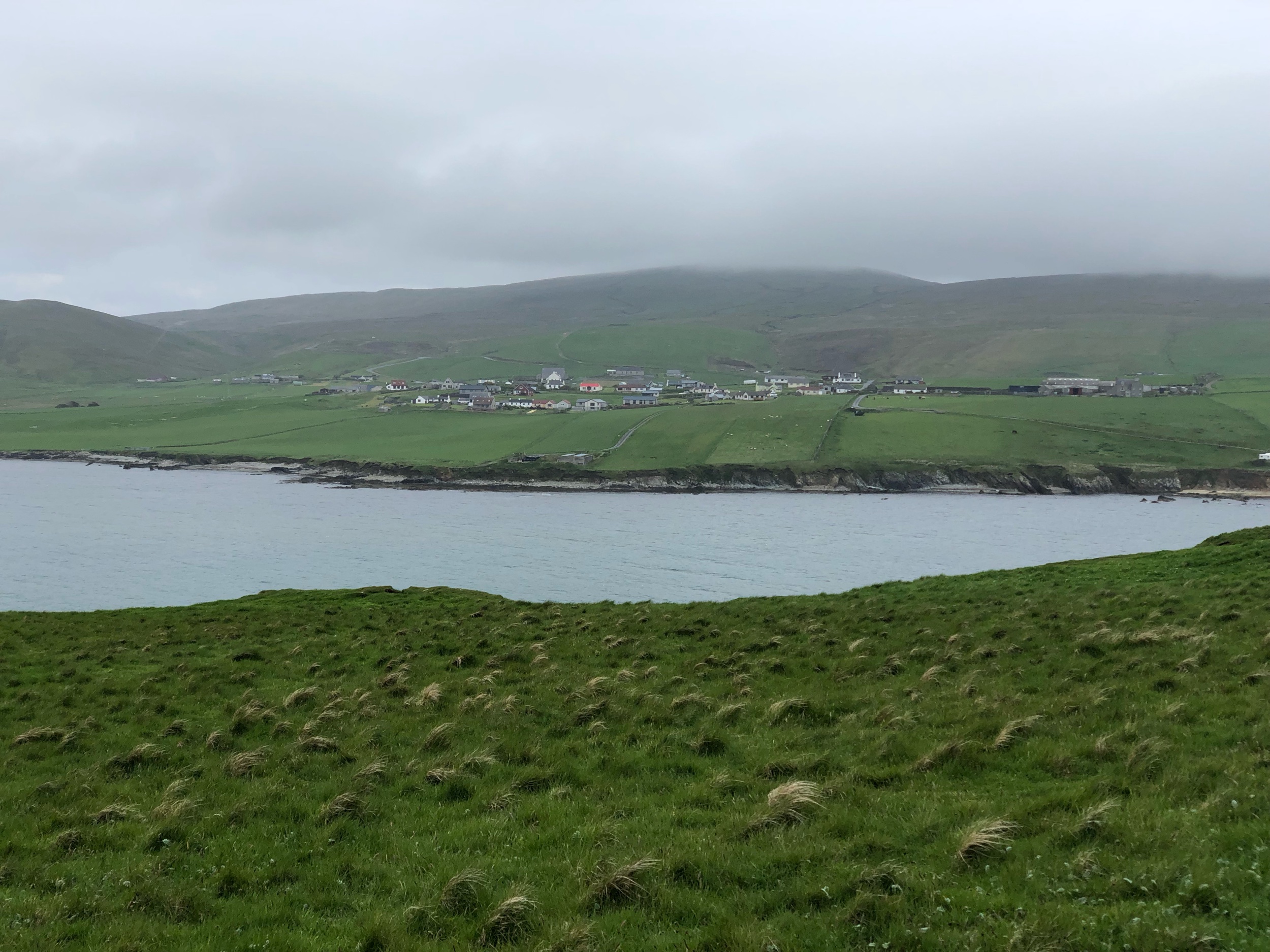
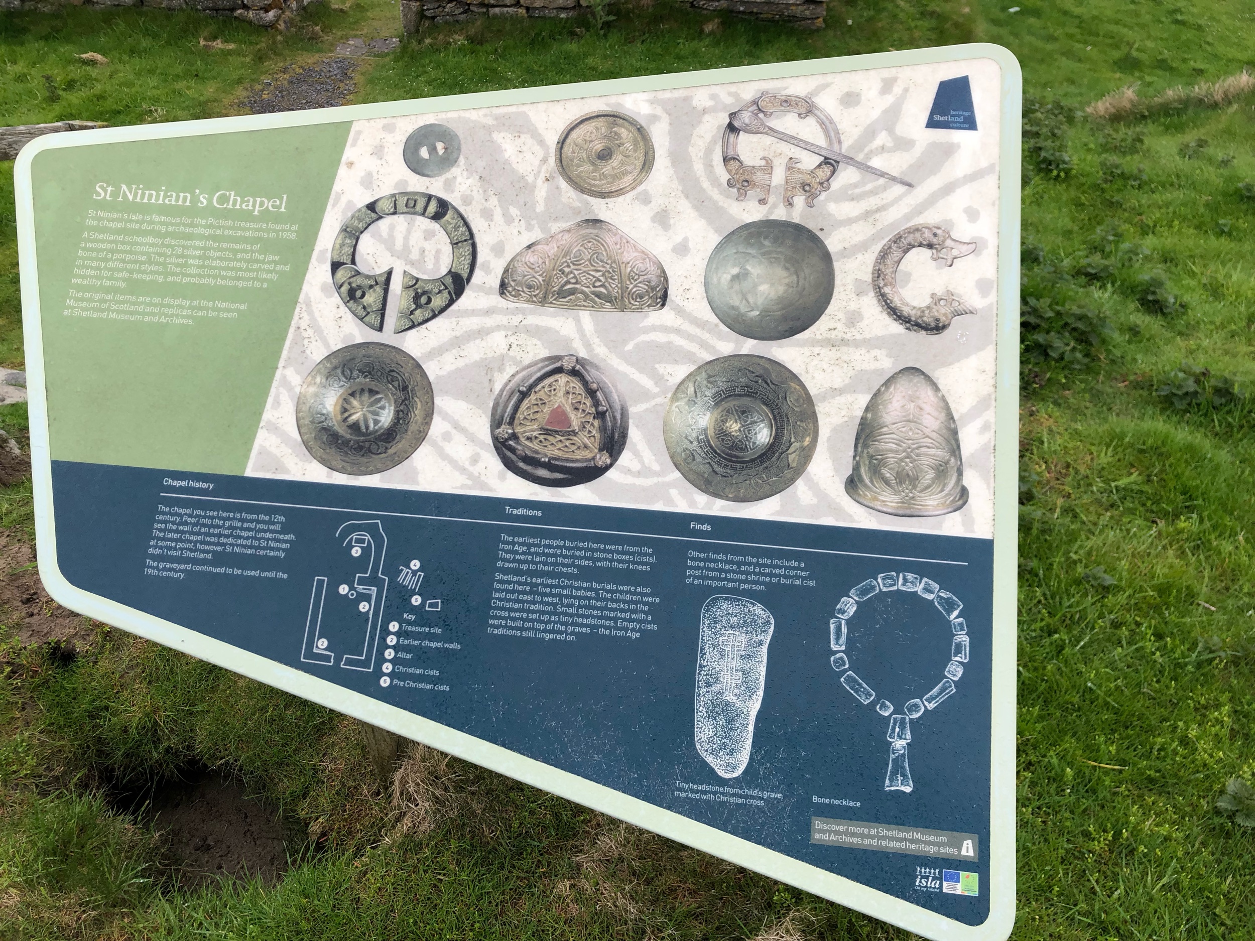
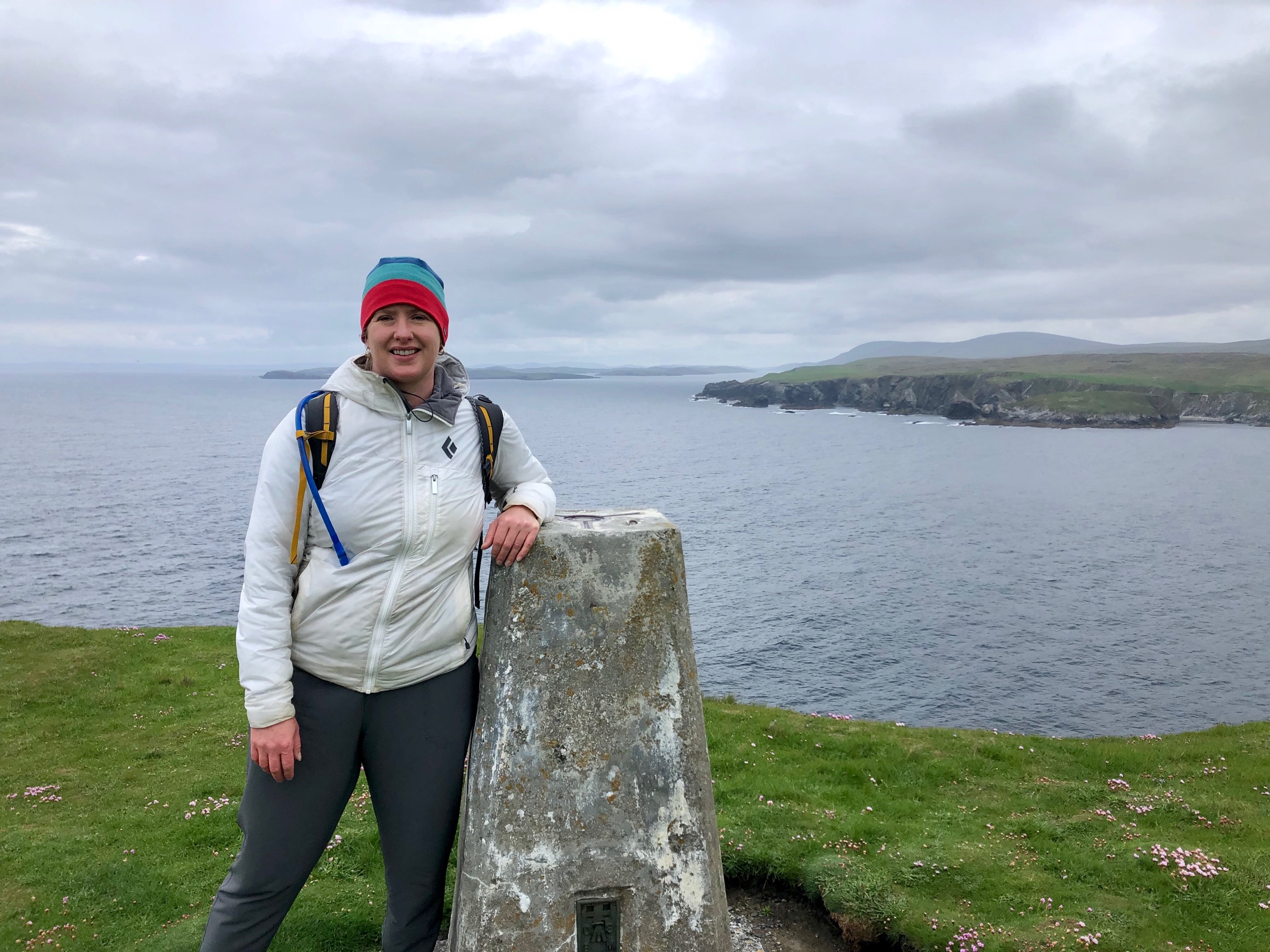
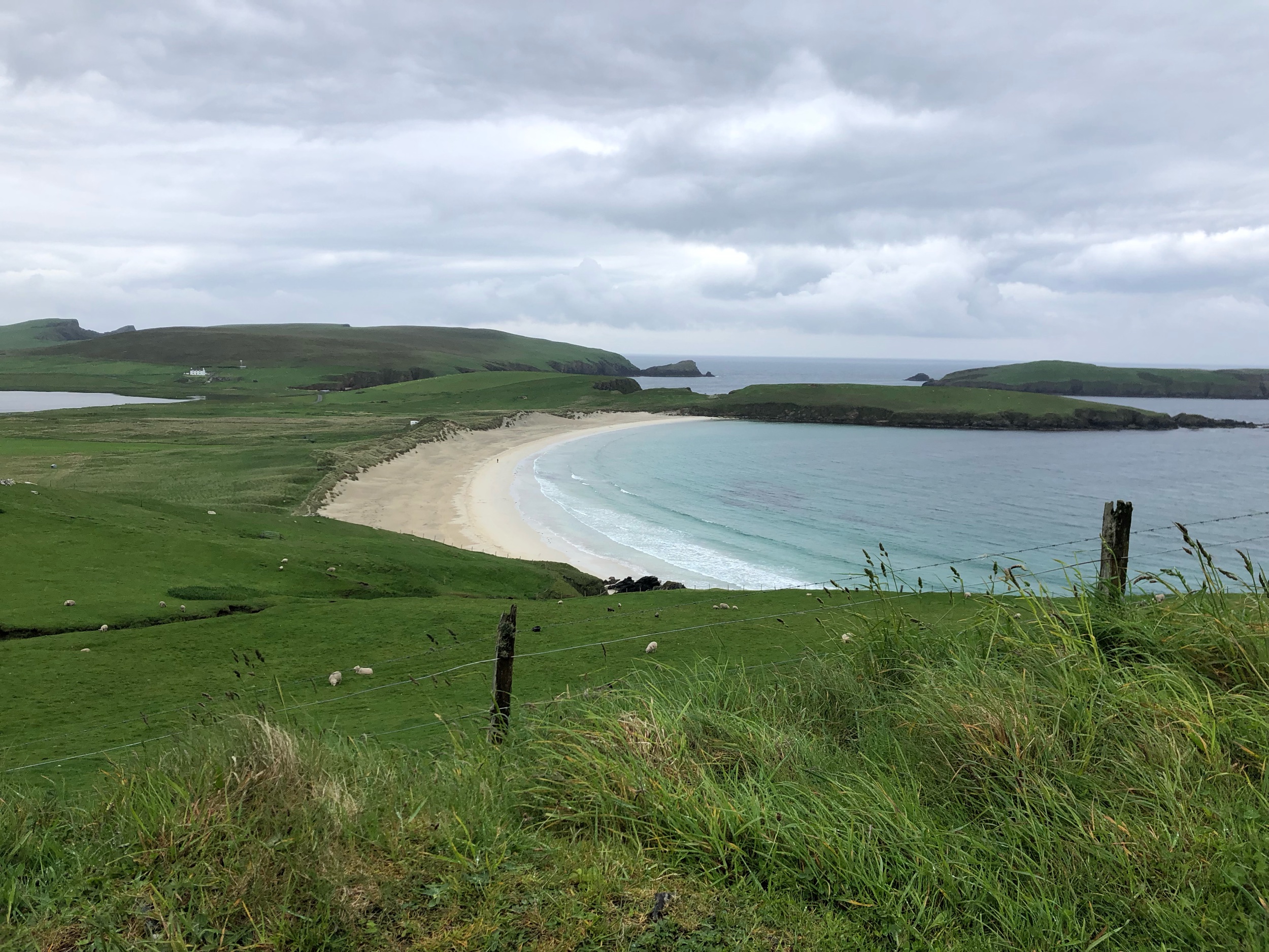
Day 2: Walk the Tombolo to St. Ninian’s Isle and take the Storm Petrel Tour of Mousa Broch

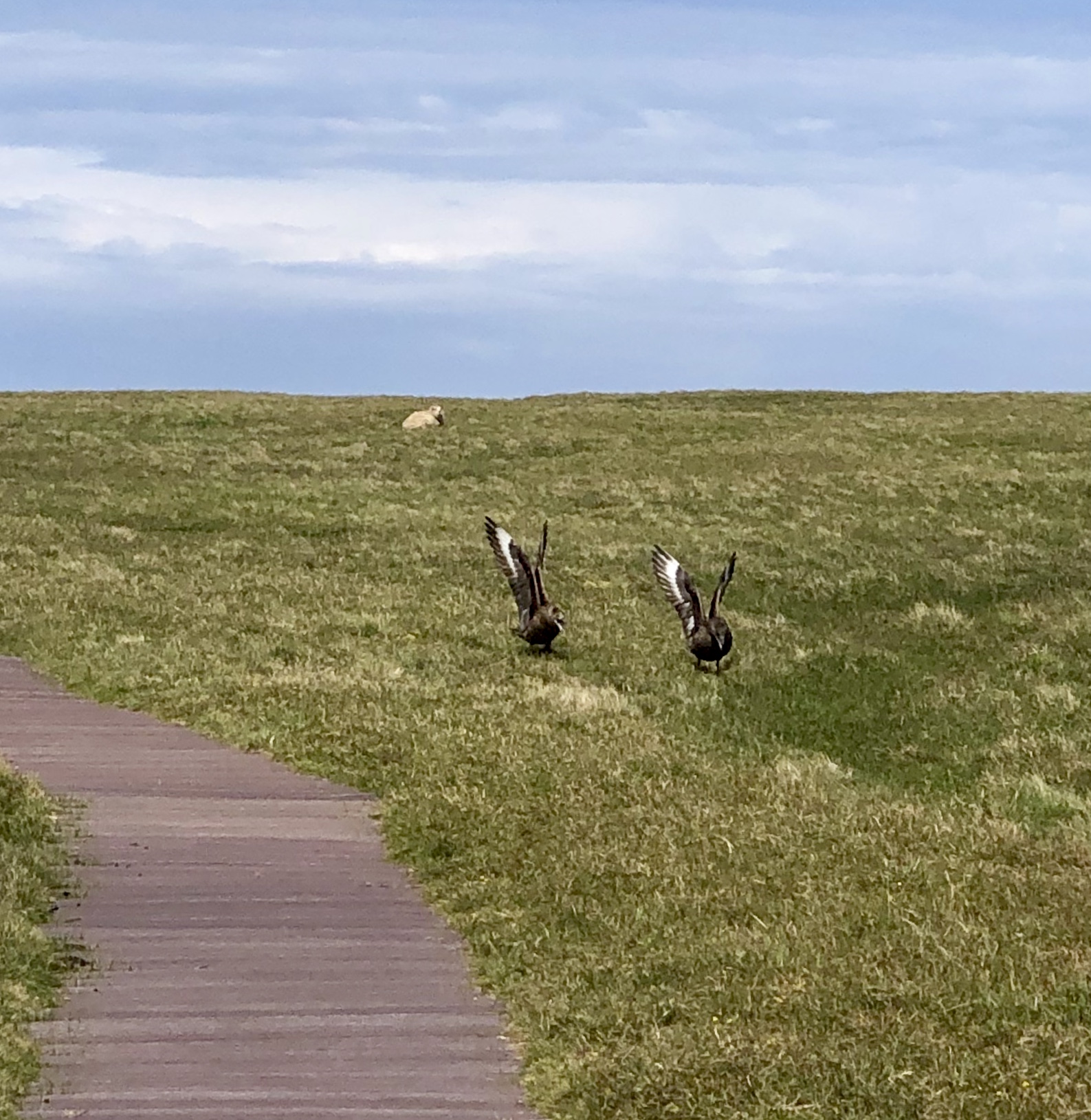
St. Ninian’s Isle is a short drive from Sumburgh Hotel, and one of the most scenic walks on the island. It will take you a few hours to explore the Tombolo beach, St. Ninian’s Isle, and the ruins on the Isle. Take care with the arctic skuas and raise your hand high if you find large birds suddenly attacking you.

Mousa Broch is worth seeing at any time, but if you can get on a dusk tour in June to see the storm petrel birds return from many days feeding at sea to their nests in an ancient Scottish broch, it will be well worth your time. Just know that you likely won’t get back to your hotel until 1 or 2 a.m. in the morning and book your tour well in advance of your trip.

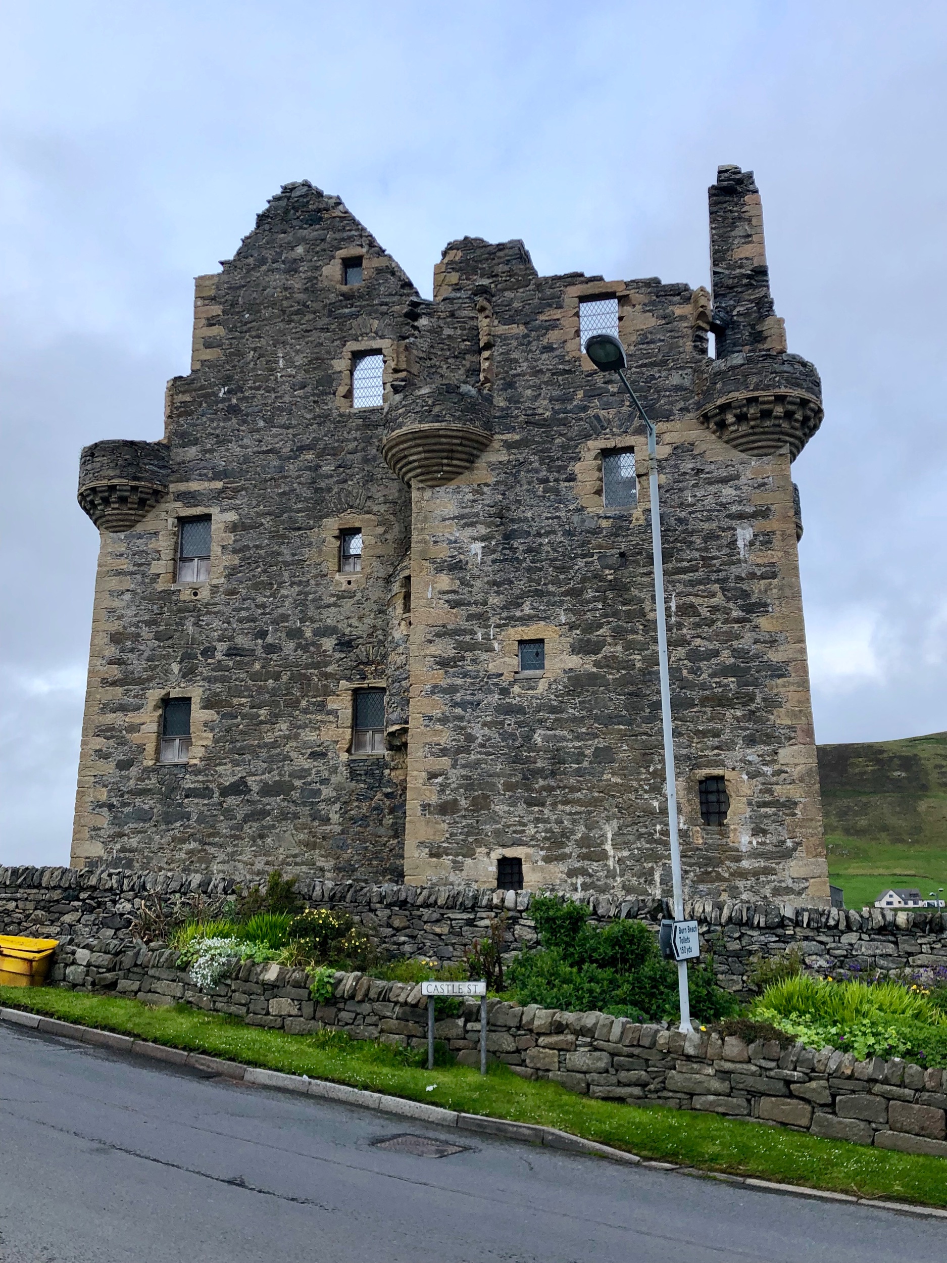
Day 3: Sea Kayak the Shetland Coast and Explore Scalloway, the Ancient Capital of Shetland

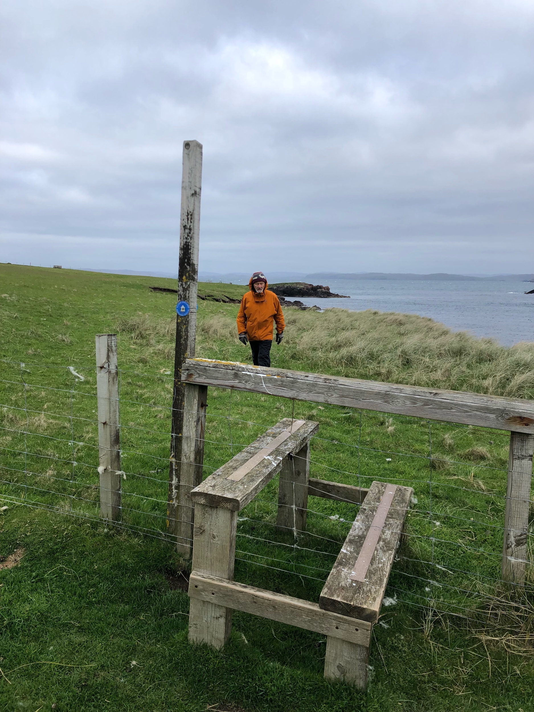
Our half day of sea kayaking was an exciting, fun adventure, and Sea Kayak Shetland caters to beginners. If the weather is not in your favor, and your trip is cancelled, then reschedule for another day and spend some time at one of the local leisure centers or find a scenic walk nearby in the book, Walking On The Orkney and Shetland Isles by Graham Uney.

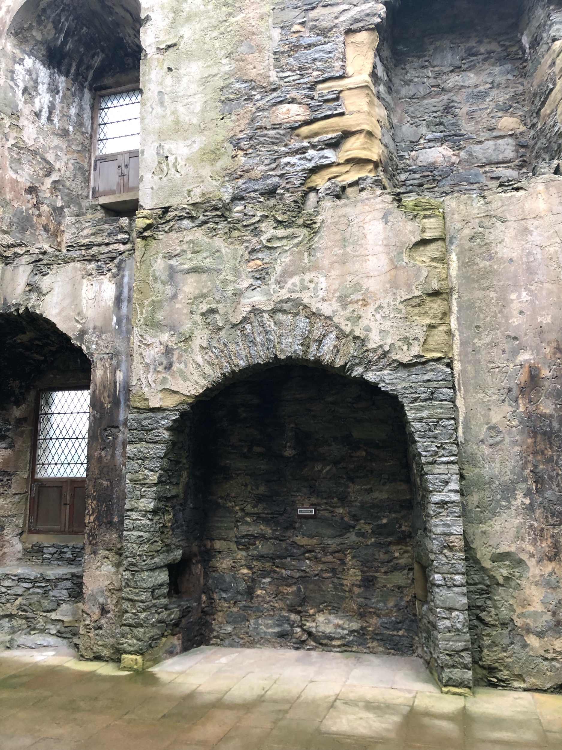
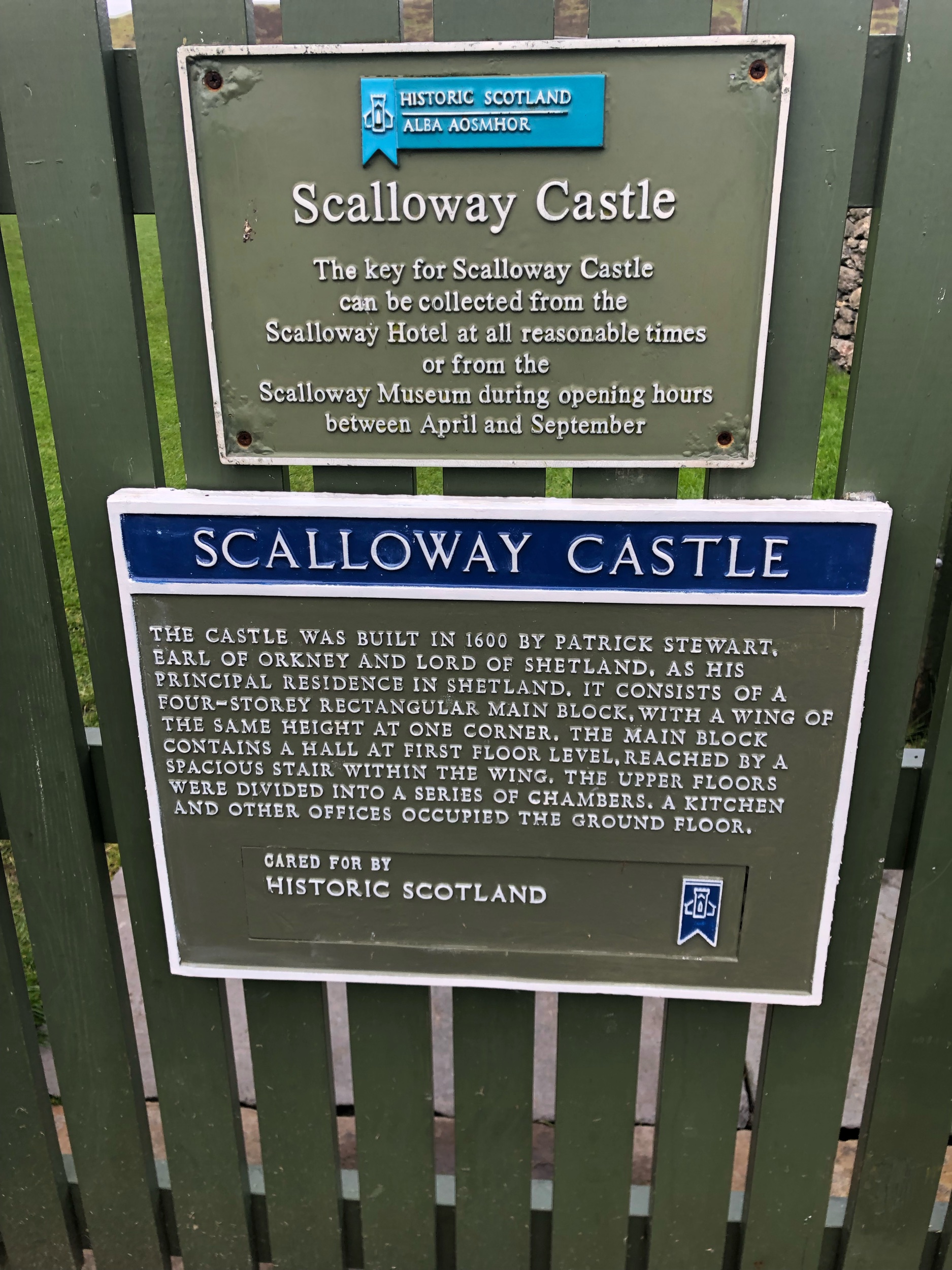
Scalloway is a short drive from Lerwick, and is the colorful, ancient capital of Shetland. Explore the local castle and museum, and have dinner at the Scalloway Hotel.

Day 4: Take a Walking Tour of Lerwick and go to Mareel Arts Centre

My favorite thing to do in large, historical cities is to take a walking tour (preferably a ghost tour) and Lerwick has a number of tours to choose from including both a wildlife boat tour and a walking tour around Lerwick. We had a blast with Les Sinclair from Roundabout Shetland. Try to time your trip to Lerwick on the weekend so you can take in a show, or see some live music, and experience the arts. A good place to do that is at the Mareel Arts Centre.

We loved two coffee shops in Lerwick: Peerie Shop Cafe and Fjara Cafe and Espresso Bar. Both of them had excellent gluten-free options (including gluten-free bread). From Fjara you can walk over by the grocery store Tesco and sometimes see grey seals as well. There is also gluten-free fish and chips served at Harbour Fish and Chips in downtown Lerwick.

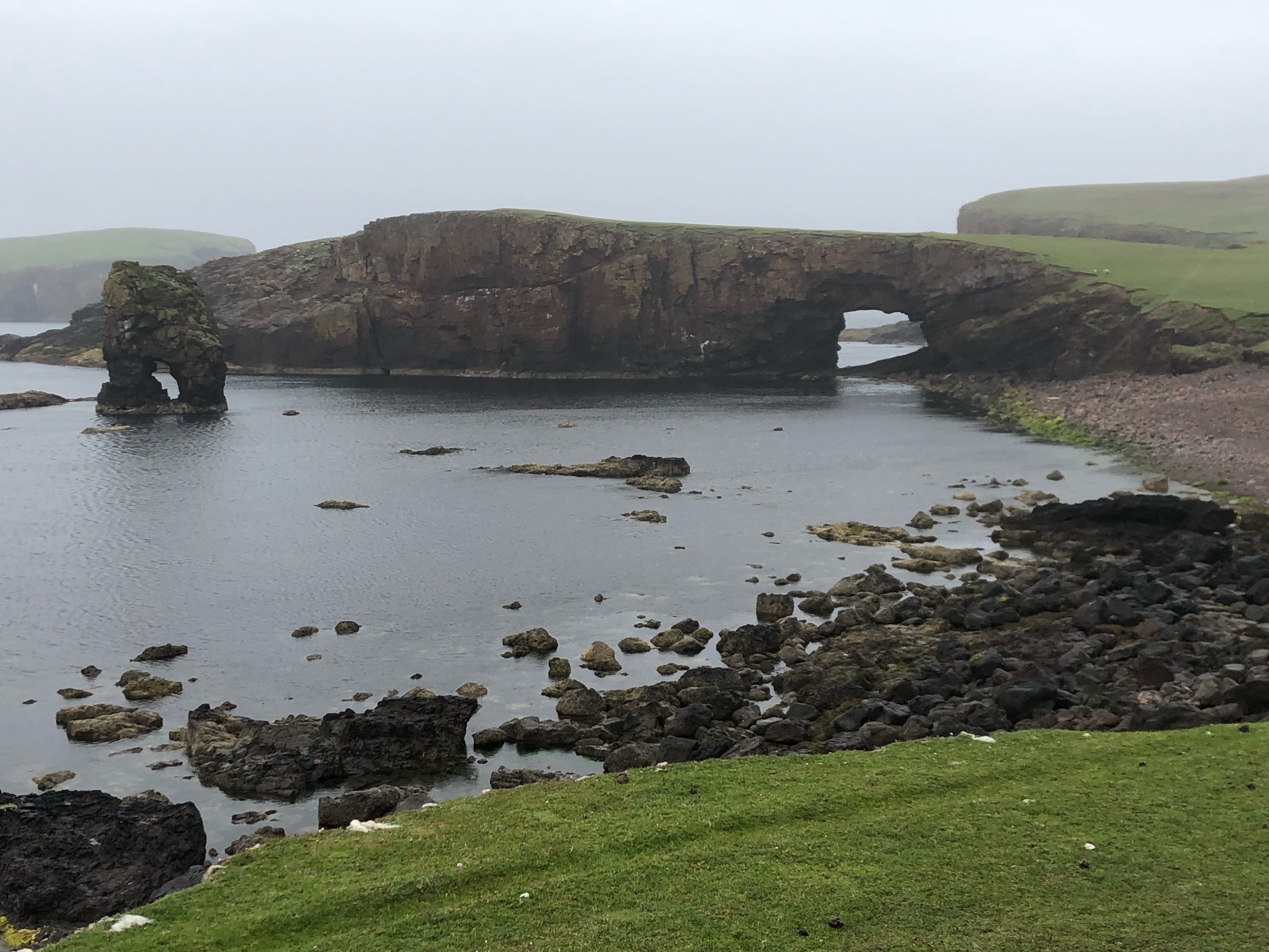
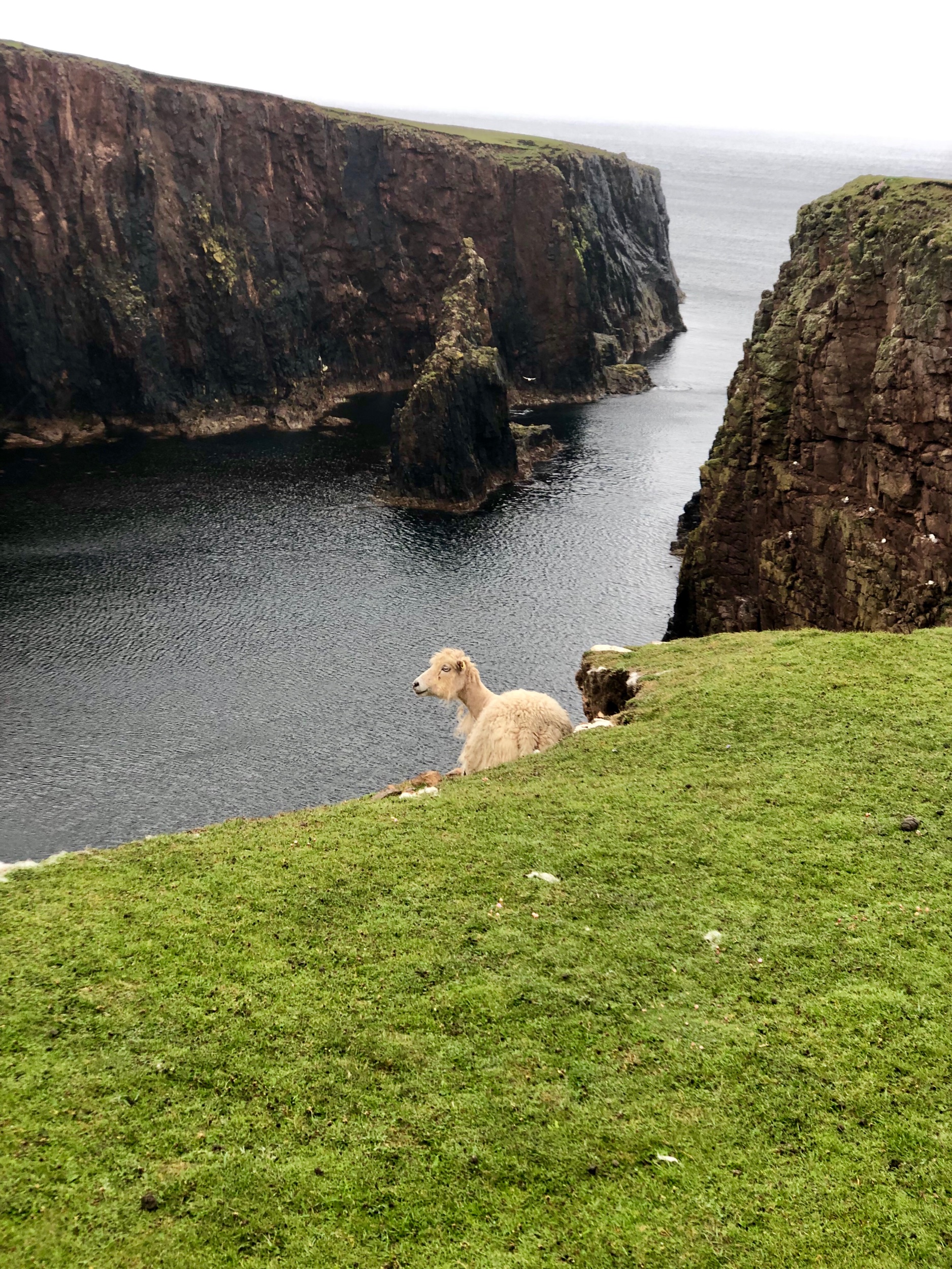
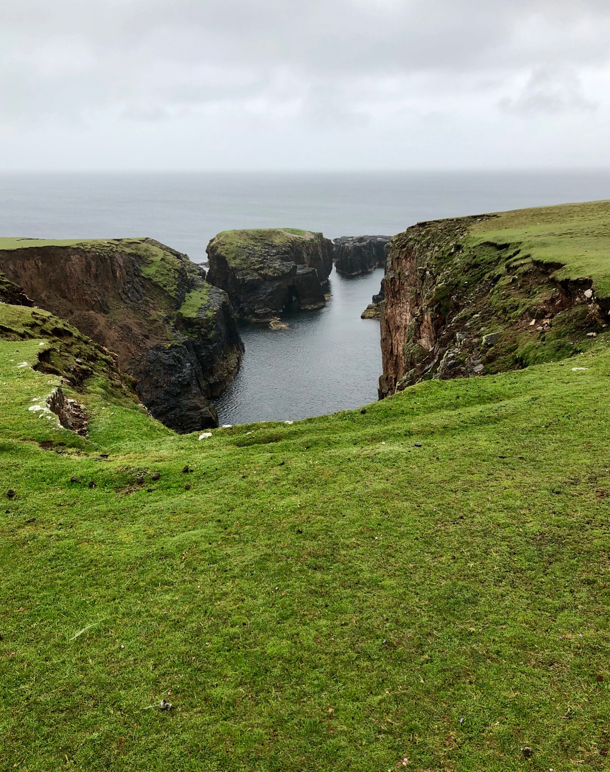
Day 5-6 : Go to an outlying island for a few days: Fetlar, Bressay and Noss, Foula, Papa Stour, the Skerries, or Fair Isle

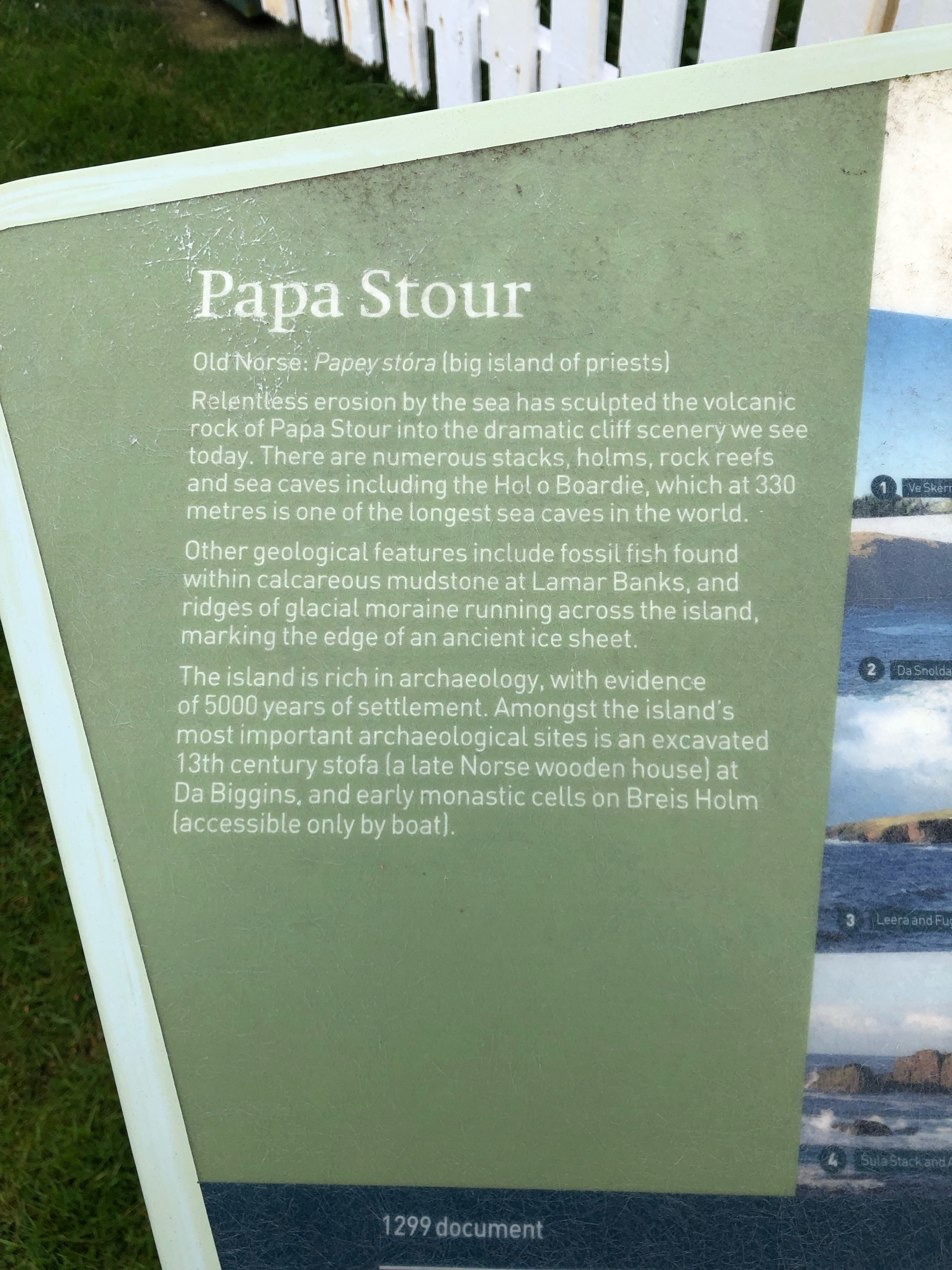
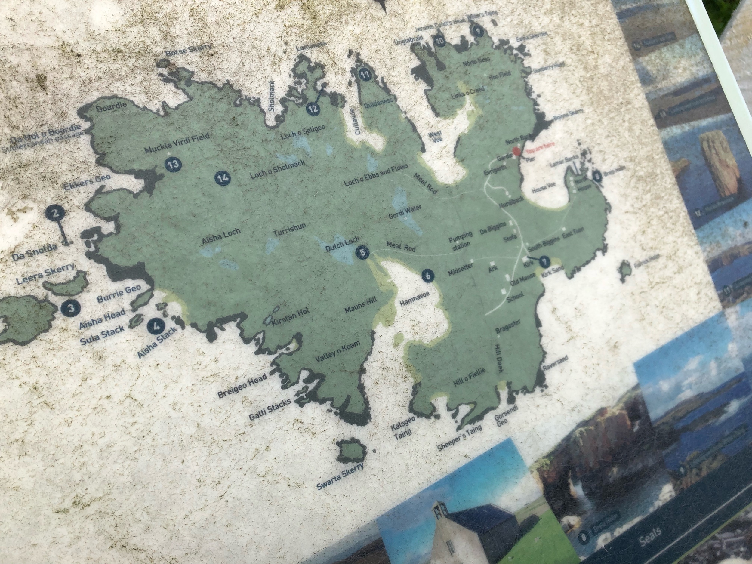
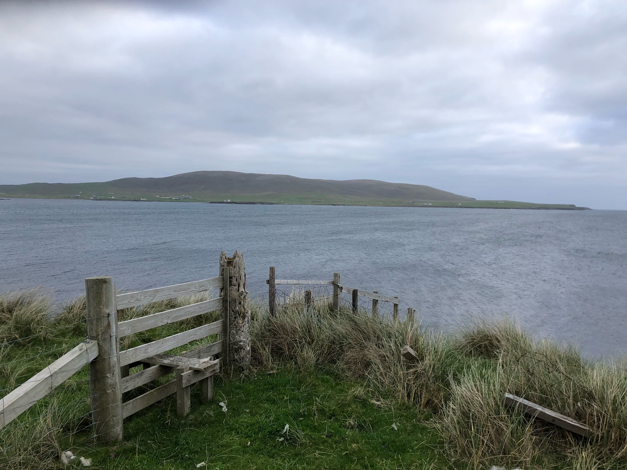
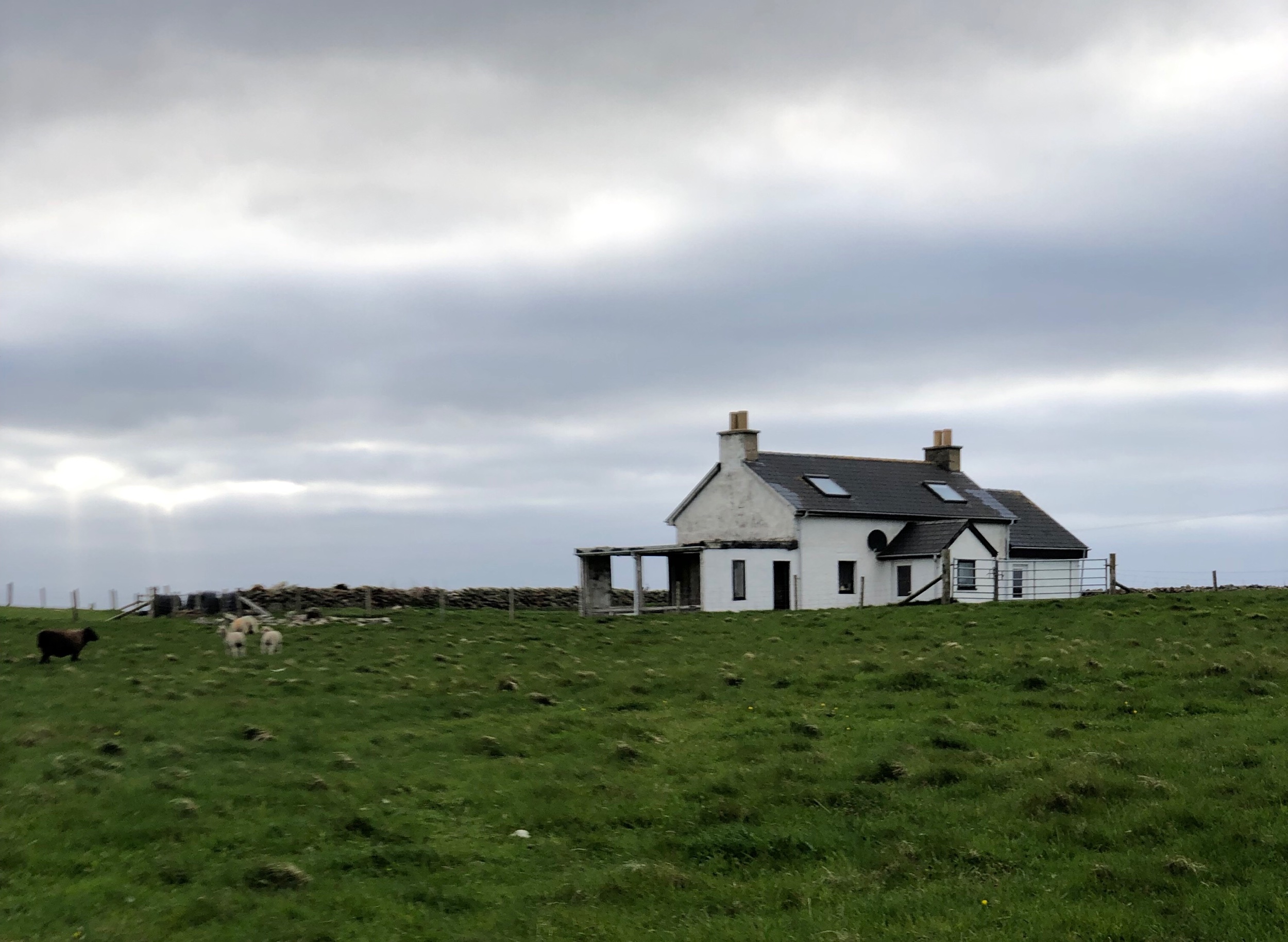
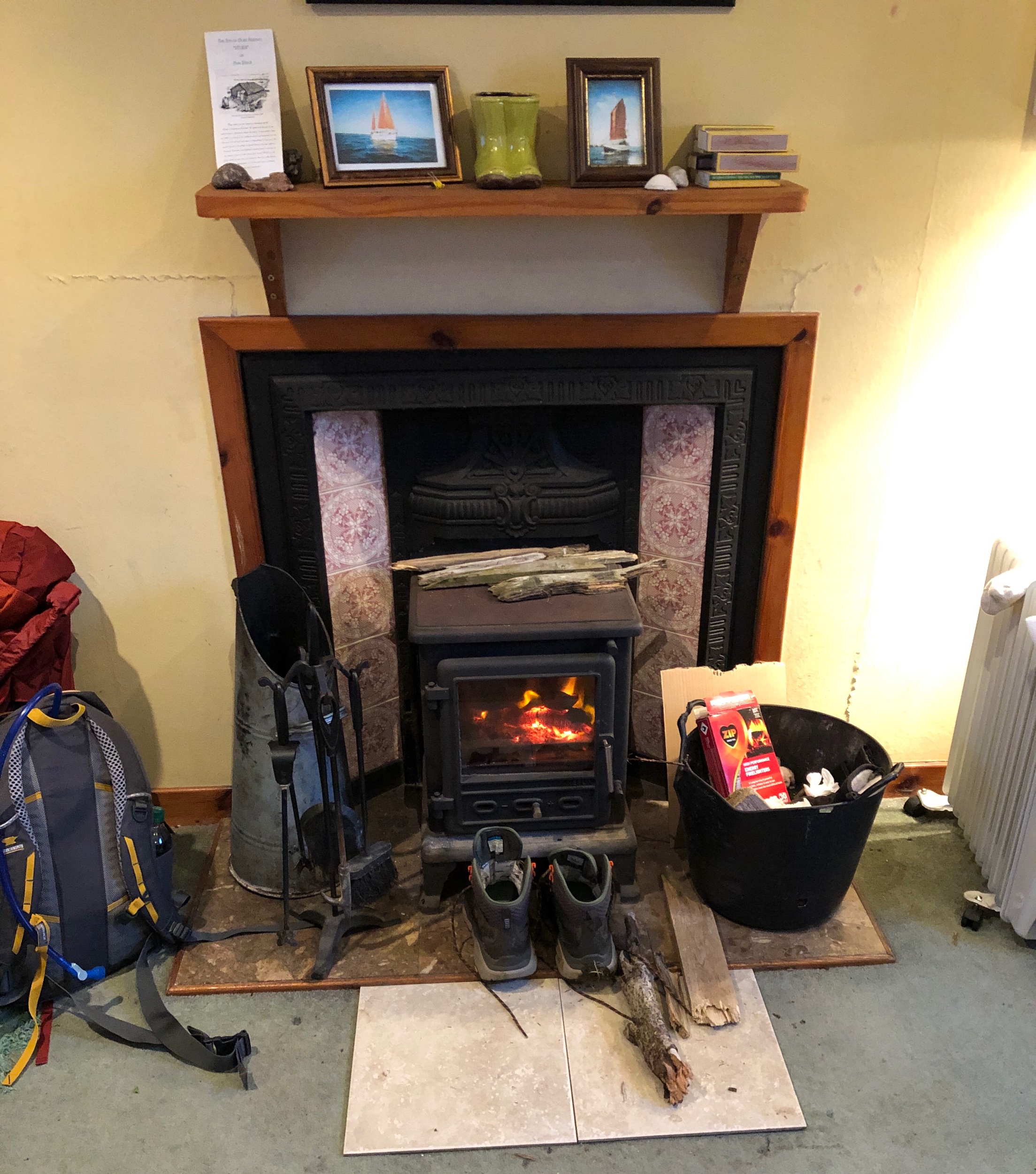
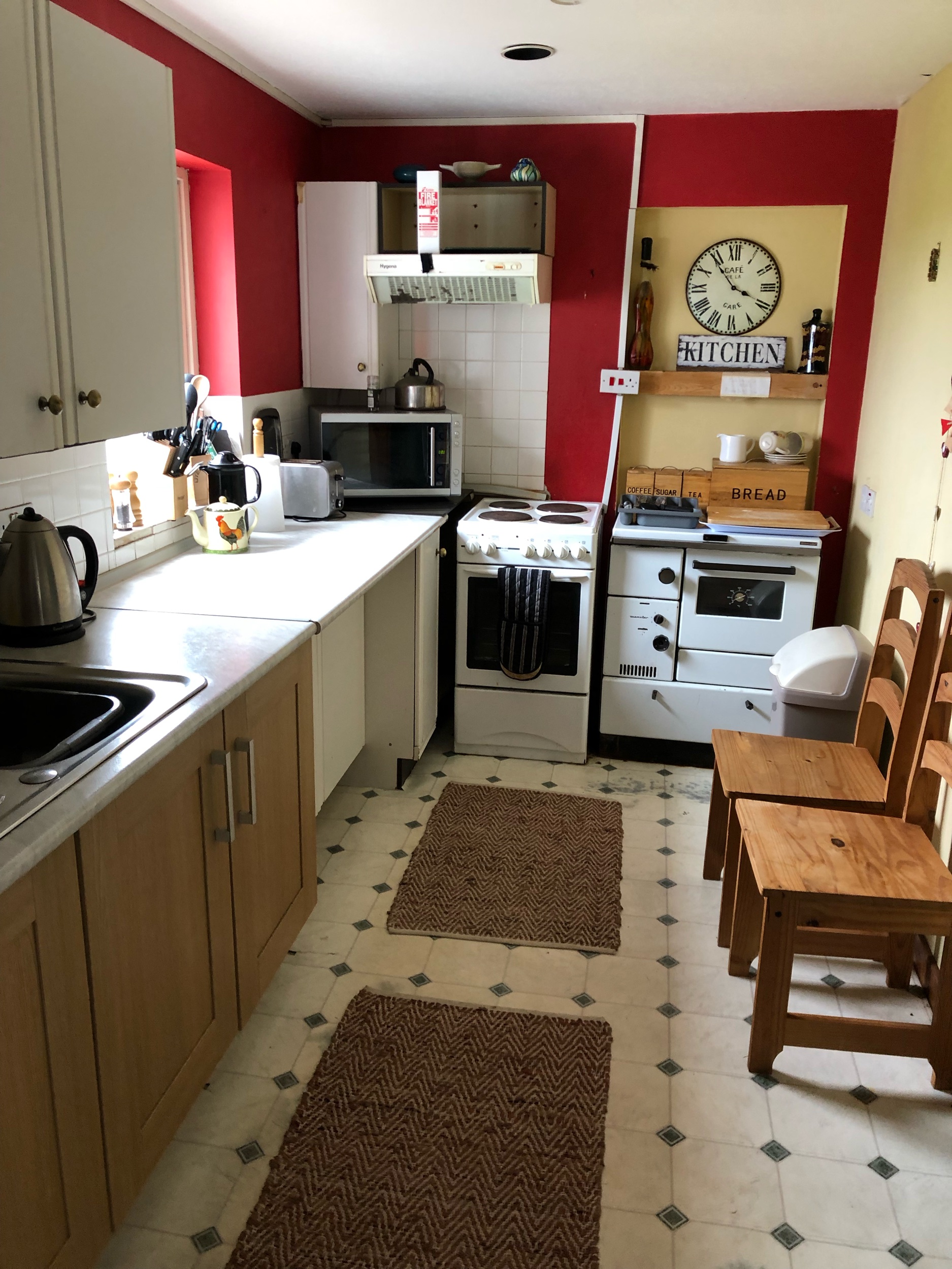
We decided to go to the island of Papa Stour off of the West Coast for several days because we wanted to go somewhere really remote while on Shetland. Plus, it was one place I could find accommodation (there is an AirBnB there). However, there are a number of outlying islands that are well worth exploring to get a flavor of Shetland. You can get help planning your trip at the all encompassing website about Shetland that goes over each area.

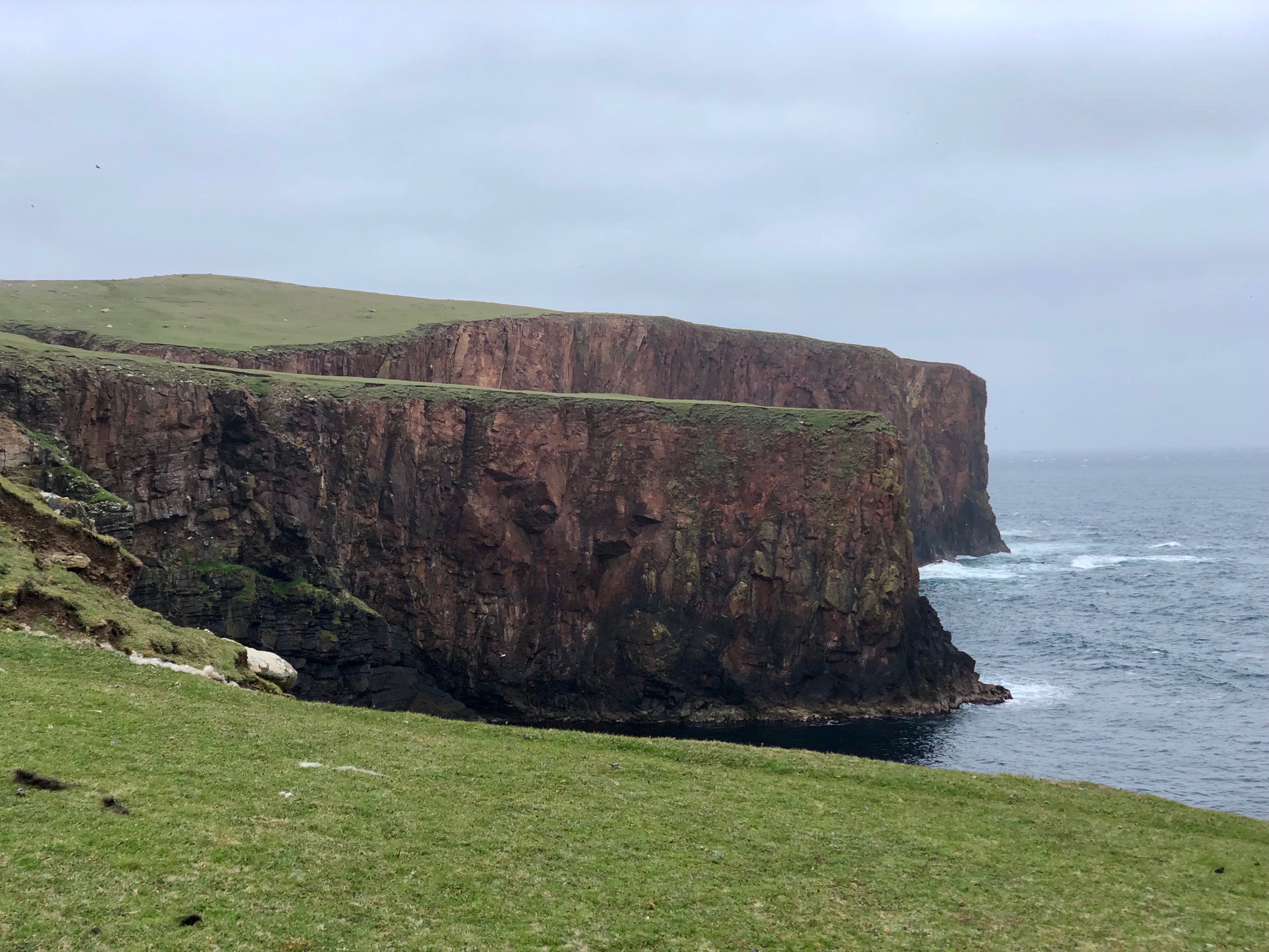
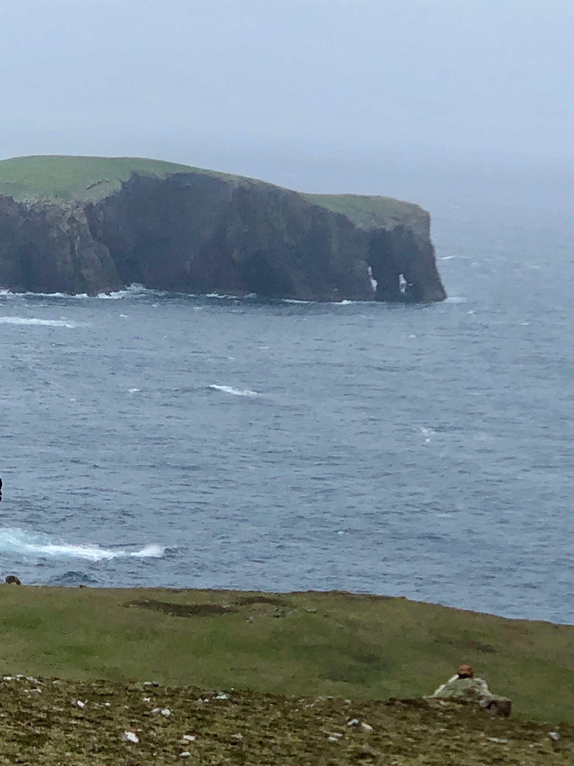
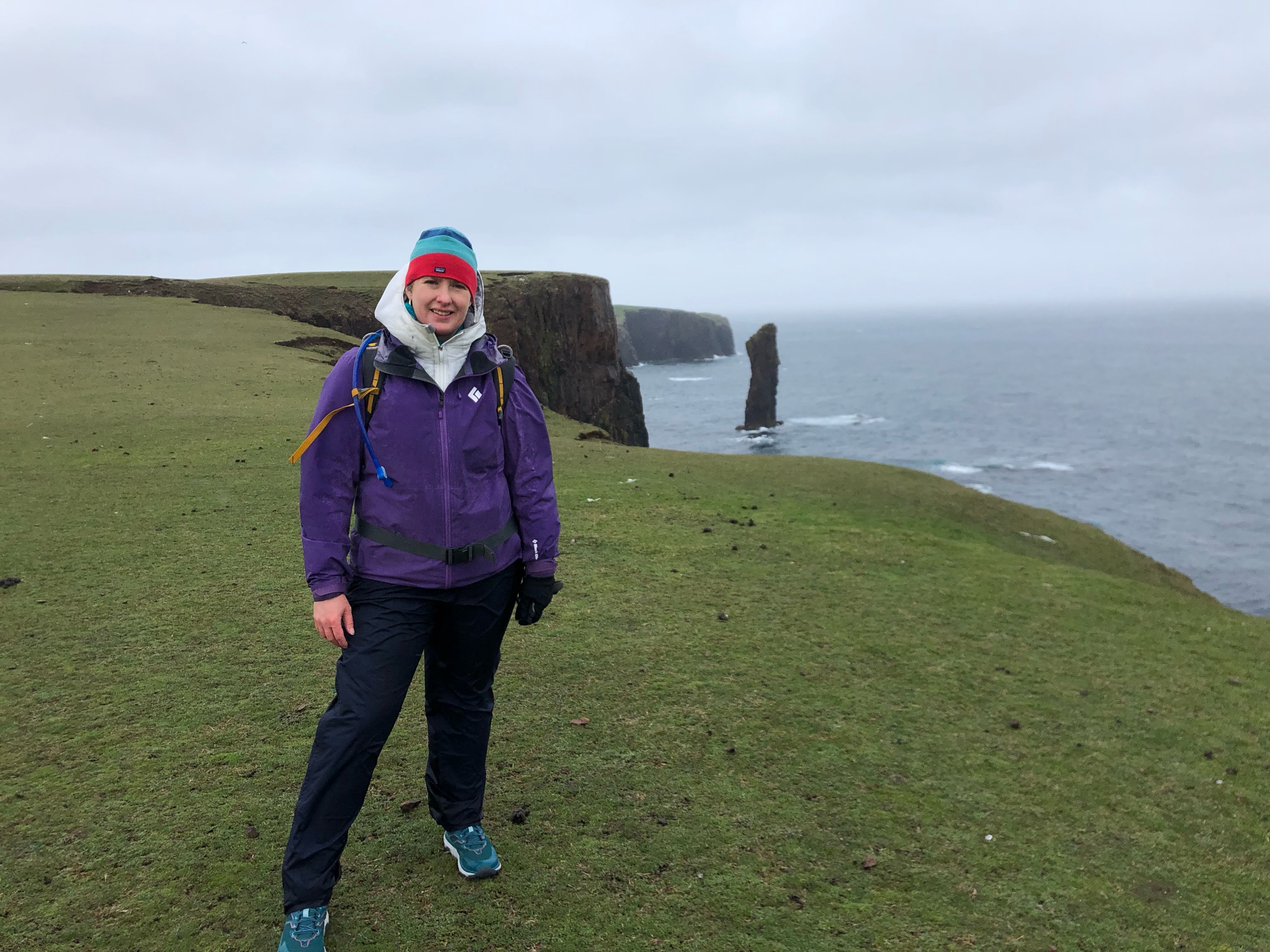
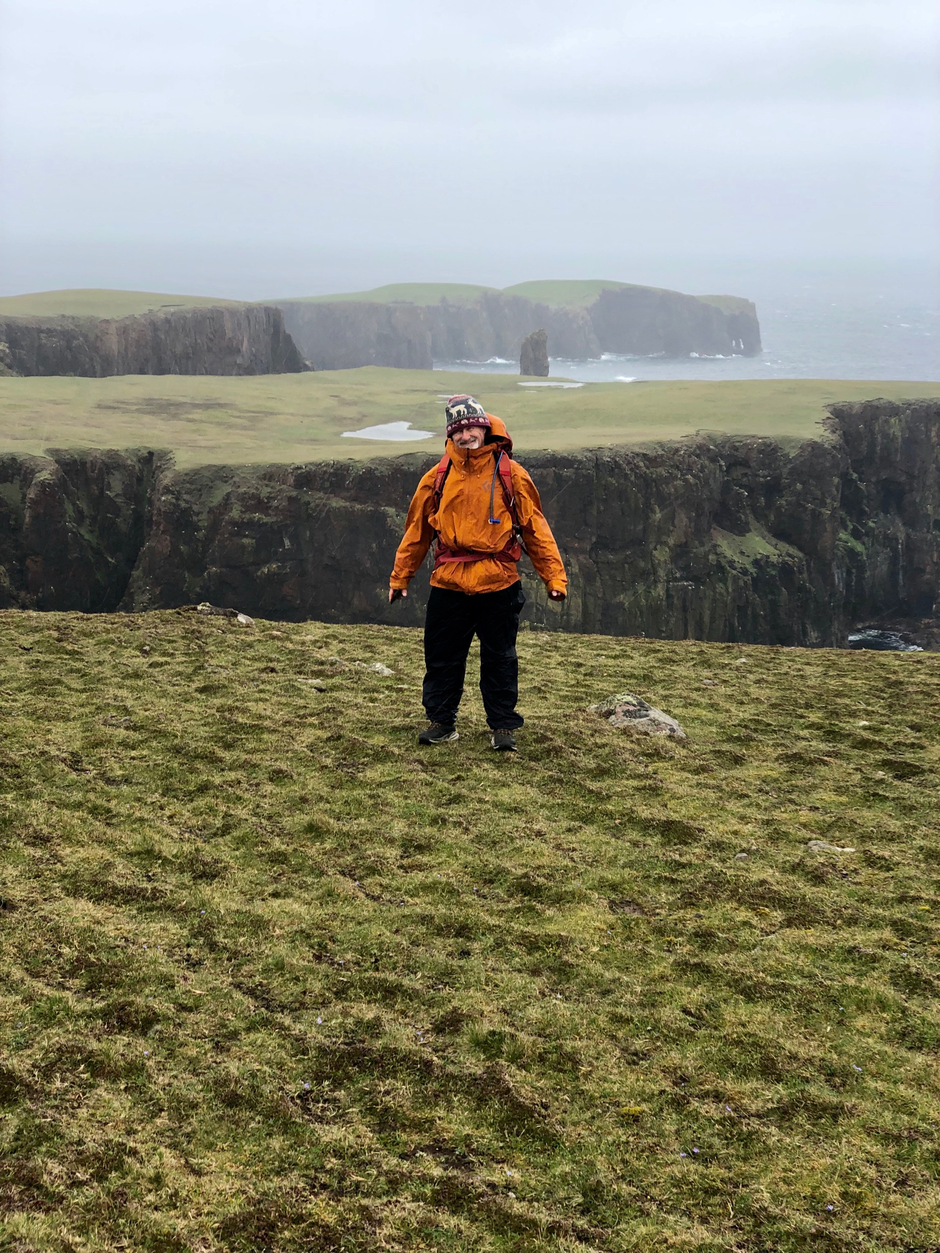
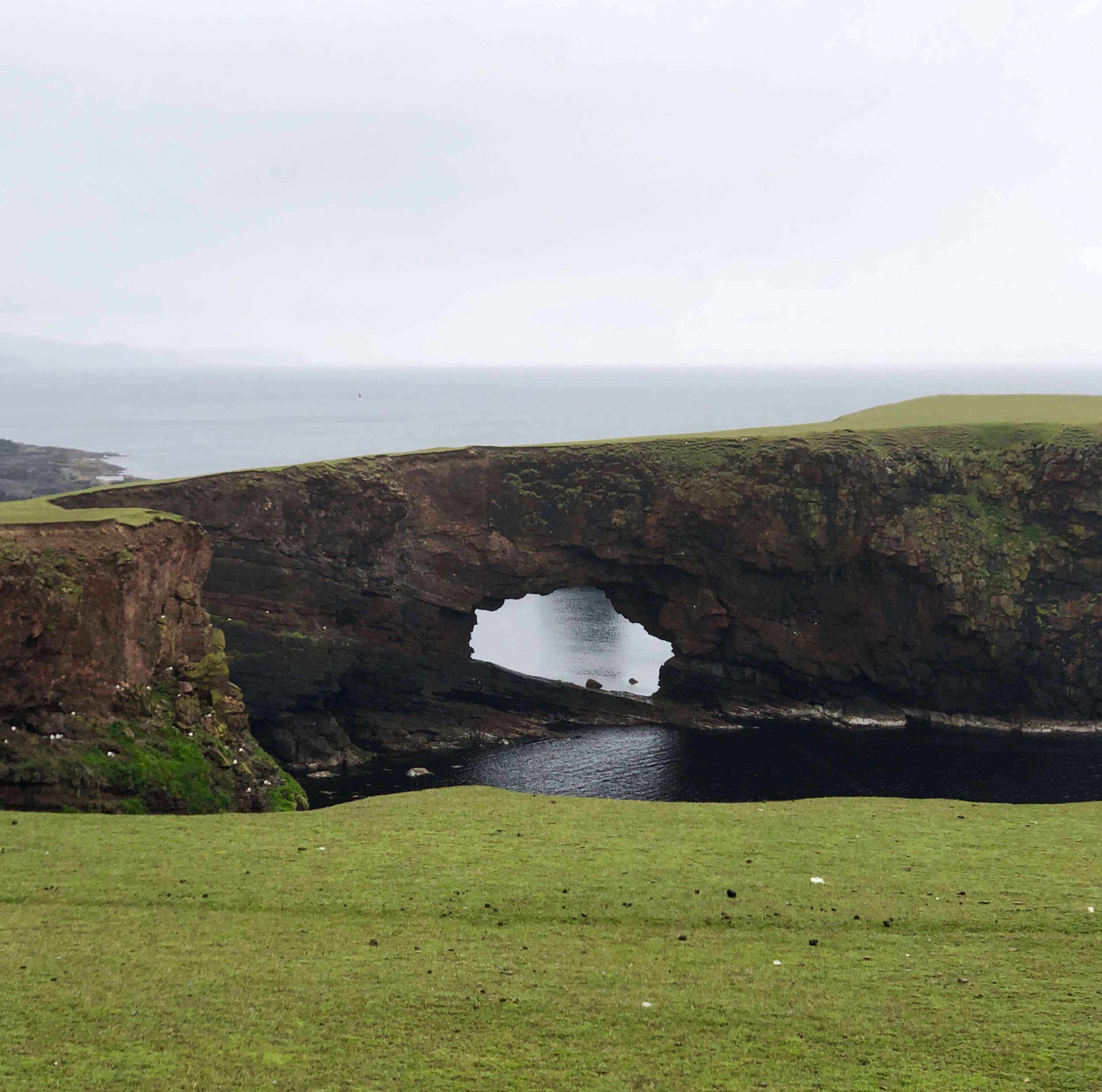
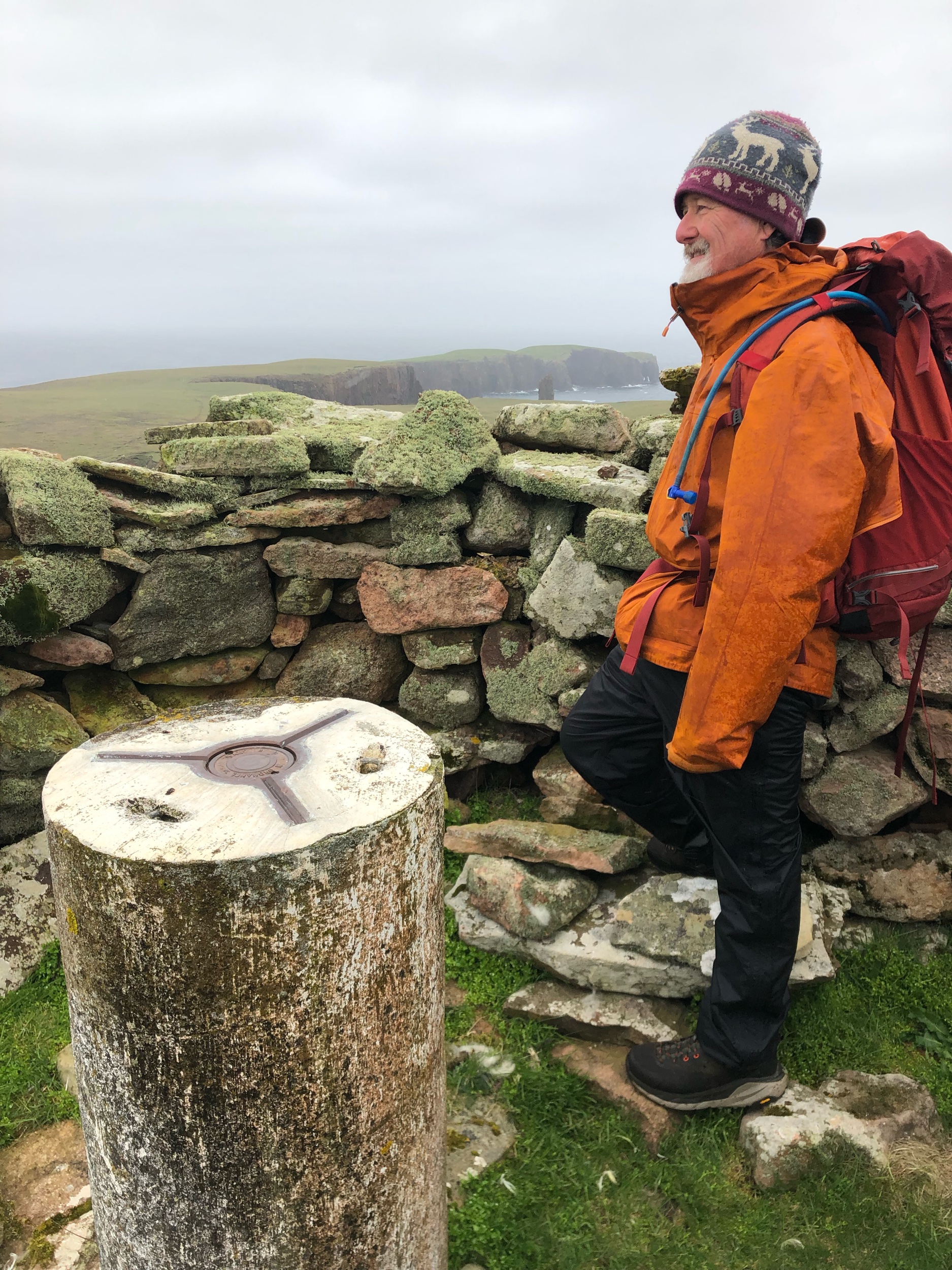
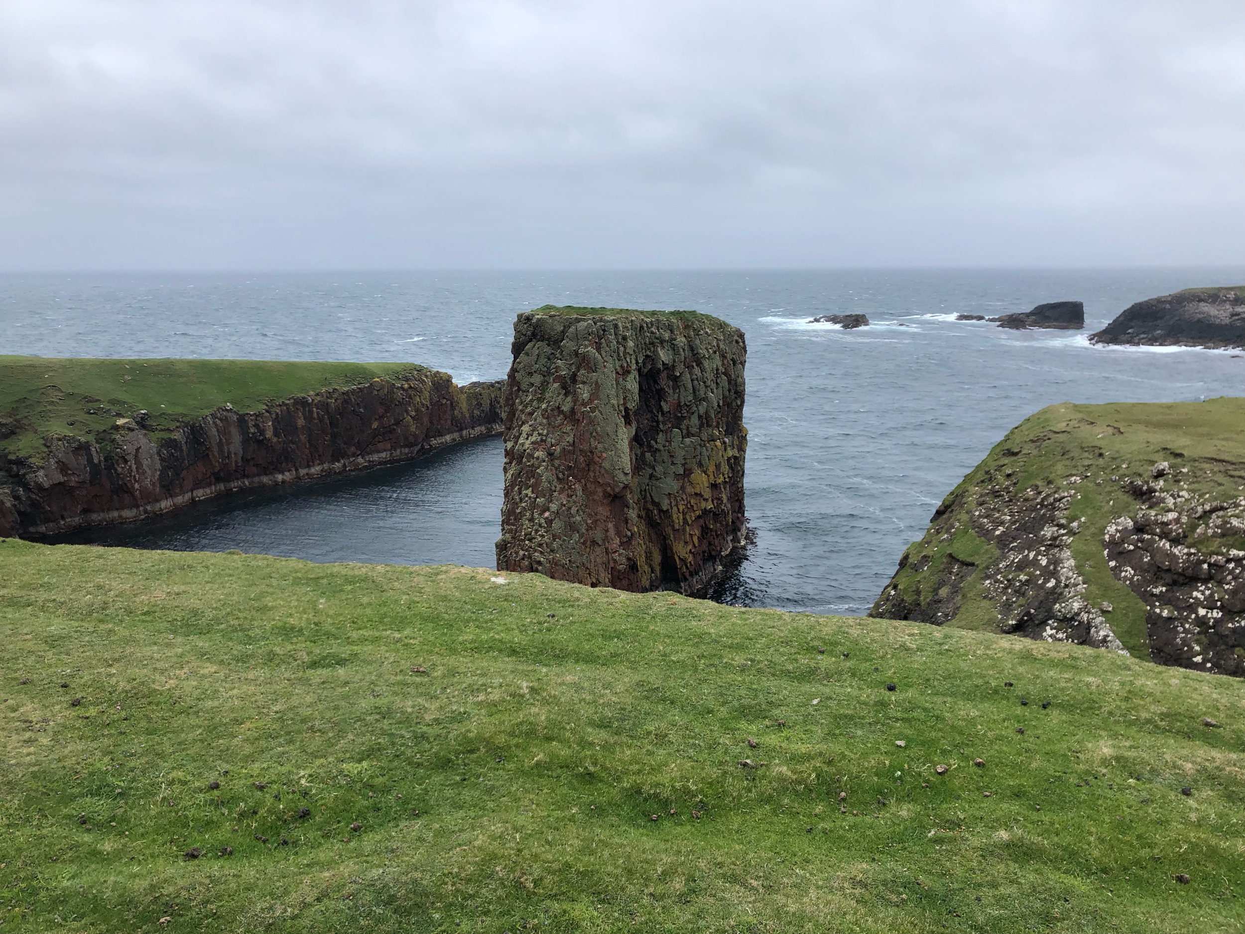
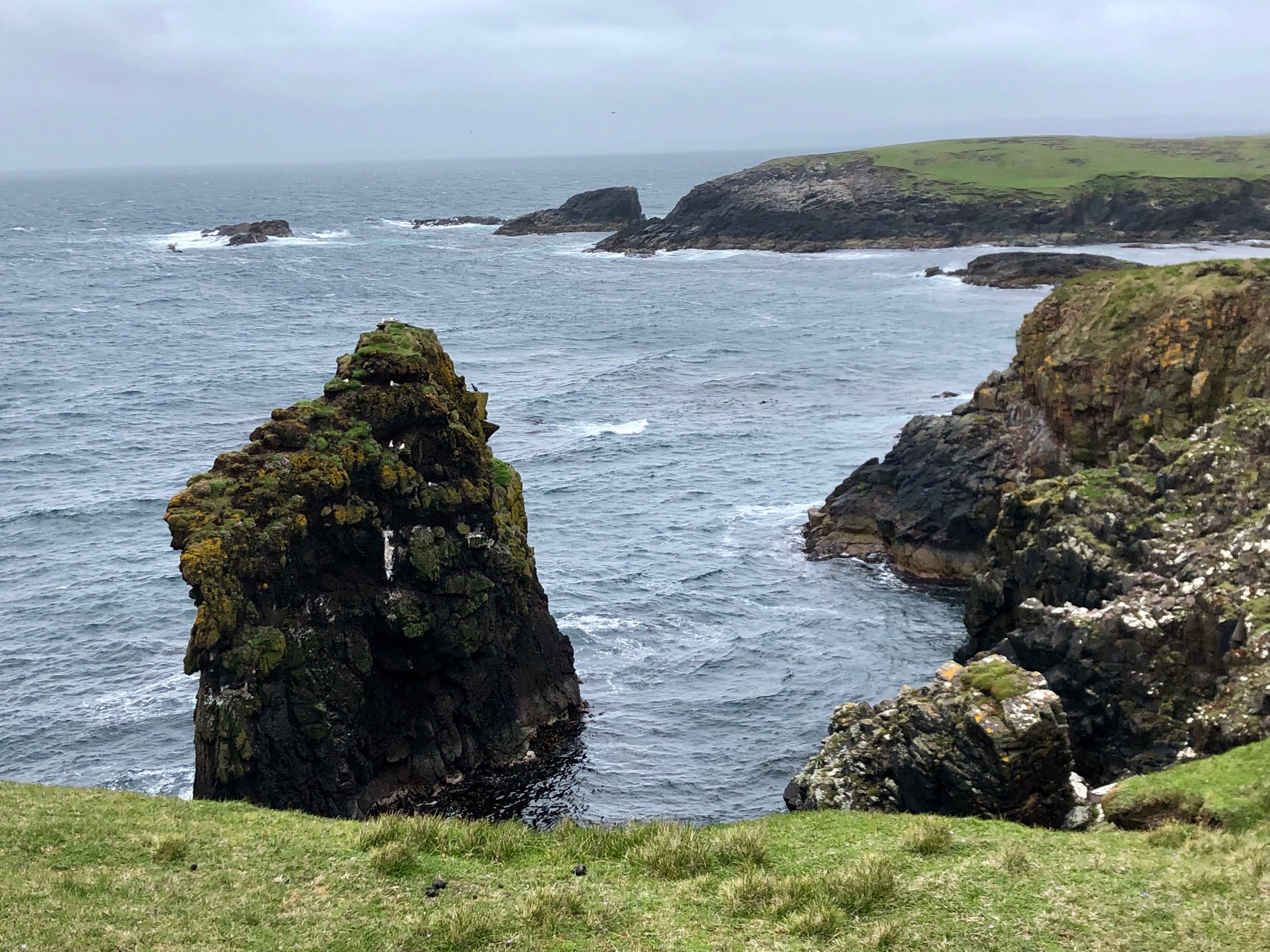
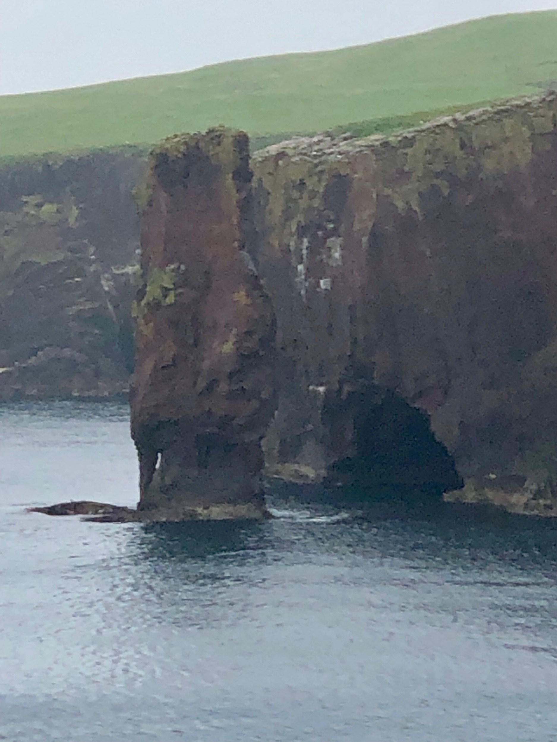
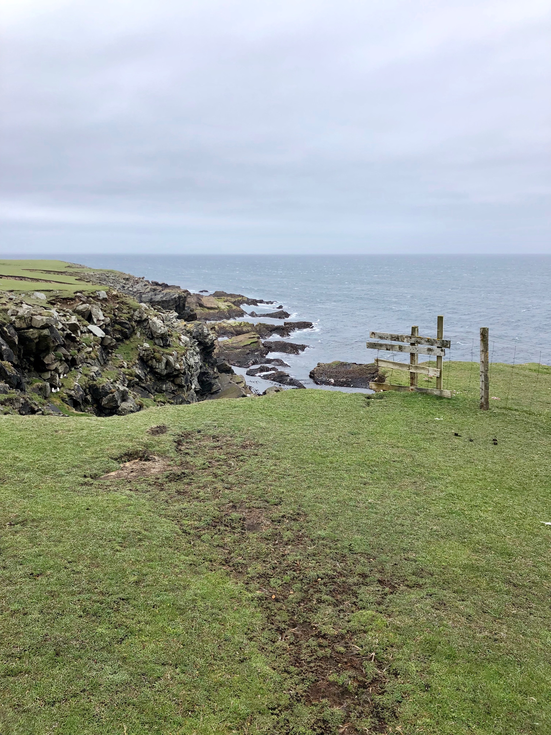
Day 7: Explore the Wild West Coast

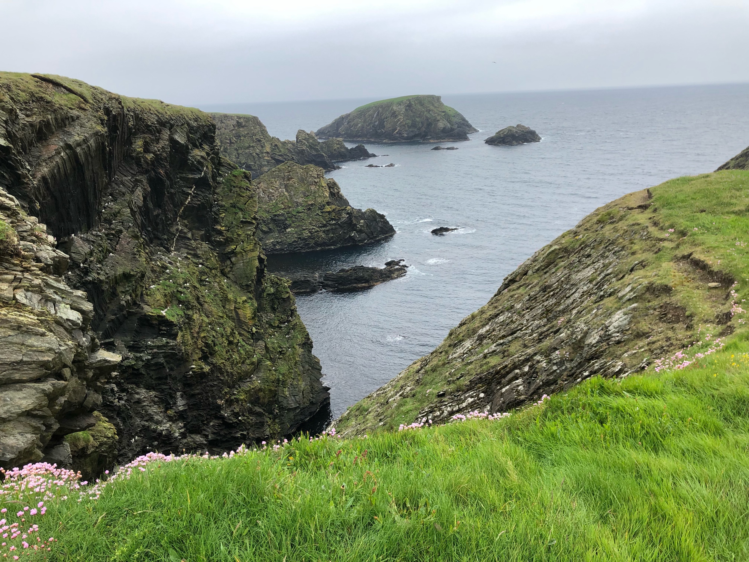
The lighthouse at Eshaness, the walk around Muckle Roe, and the coastal walk at Sandness were some of our favorite experiences on Shetland. The west coast is more remote and the waves can be seen crashing into the cliffs and rocks there. Plus, do not miss the most northerly fish and chips shop in Britain in the town of Brae. Frankie’s Fish and Chips is a must-stop! Call ahead if you’re gluten-free. They have a dedicated fryer.

Day 8: Have fun in Yell

Yell is a beautiful island that often gets missed because people are too busy trying to get through it to get north to Unst. Stop at the Old Haa Museum for tea, visit the shops at Aywick, and have coffee and dinner at LJ’s Diner & Pizzeria in Mid-Yell. Check the Lerwick newspaper for local events. We were there when Yell was hosting a Regatta and there were games, music, and food for all comers.

Day 9: Visit Hermaness National Nature Reserve on Unst and become a Viking.

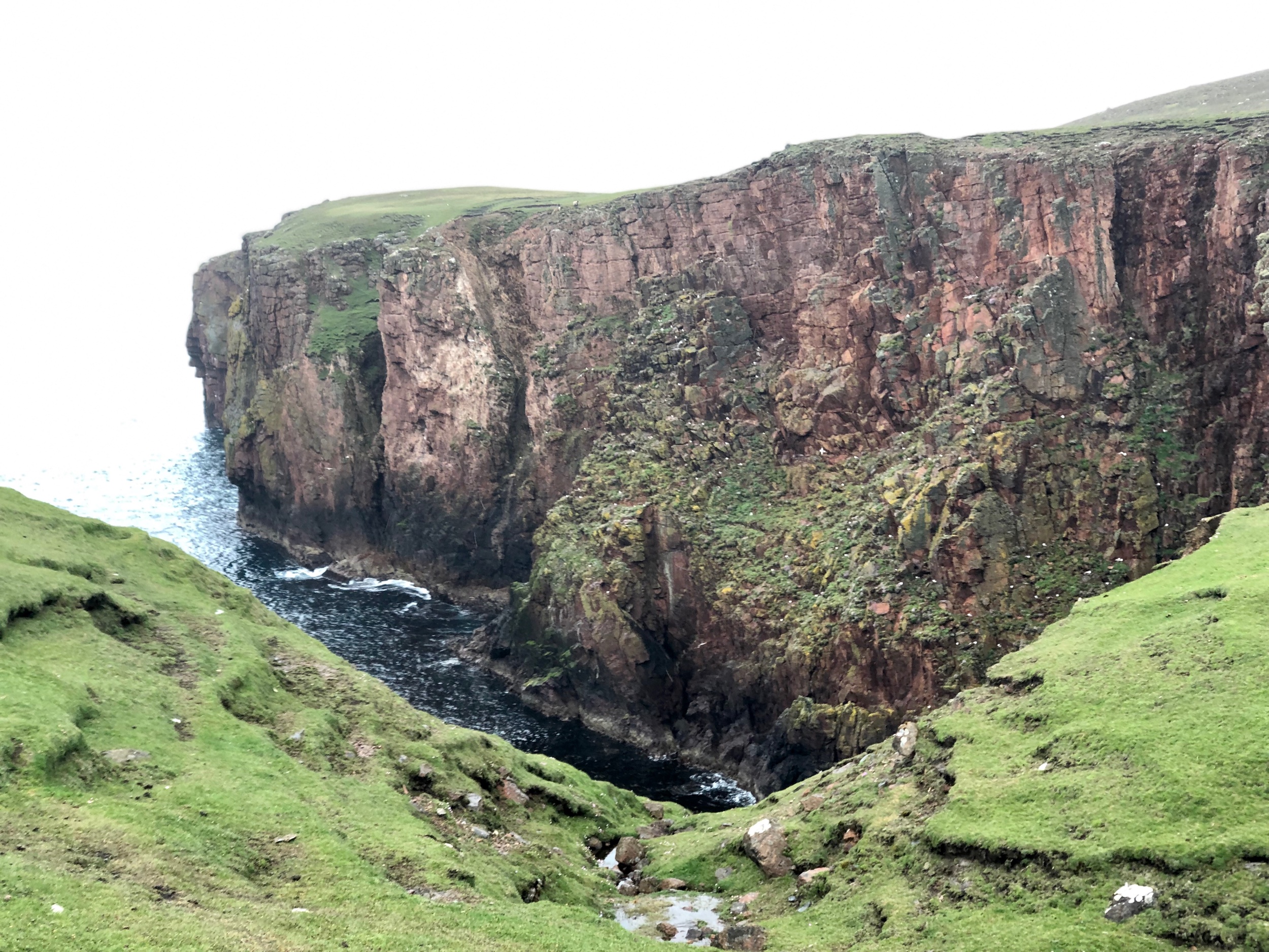
Unst was the most touristy island we visited on Shetland but you can see why when you climb the hill at Hermaness and see thousands of sea birds flying off the cliffs. It’s spectacular. Do not rush the experience. It’s well worth spending every minute with all of the puffins and other birds.

On the way to the northernmost part of the island stop and visit the Viking replica ship and longhouse along the side of the road and get coffee and refuel at The Final Checkout shop and restaurant in Haroldswick.

Day 10: Return South

It doesn’t take long to cross Shetland, no matter which way you go, but there are ferries involved when you go island to island so make sure that you have a solid day to travel south before you fly out just in case any unexpected trip hiccups slow you down.

One thing to note. Shetland rental cars do not come with spare tires, so that’s also a consideration when traveling. If you’re traveling by car to one of the outer islands, try to do so mid-trip so that you have plenty of time to repair your vehicle if anything goes wrong. You’ll also want to plan for weather delays or fog if flying. But otherwise, everything should be grand!

Day 14 of The Shetland Diaries: The Return Trip Home

IMG_4419.jpeg

Today I’m writing about jet-lag while being jet-lagged.

I really didn’t think it would be as bad as it is, but I’m on my third day, and I can definitely recommend that people give themselves three days of recovery going west. Going to Shetland wasn’t that bad, but coming home has felt like a slog through a mental mud pit.

It also didn’t help that I decided to give up my three cups a day of tea habit that I started in Shetland (when in Rome, you know), so I’m also caffeine deficient. Or that the airline served four glasses of water, one of which I missed while sleeping. I’ve been drinking water in the gallons to catch up.

When we left, I felt pretty good. Our driver didn’t have to arrive at a terrible hour. He picked us up at 8:30 a.m. after I texted him detailed directions to make sure he didn’t get lost. For once, we had an easy going ride to the airport. Asfand was very laid-back.

But when we got to the airport, nothing was laid-back. We had to ask for directions to find Air-Transat. Once there, we checked in our carry-on bags, and got our boarding passes, and then an employee with Air Transat asked us to weigh them. Combined, our two bags each had to weigh under 10 kilos. They did not.

“Can you get rid of 3 kilos out of there?” she asked.

We looked befuddled. I asked about that price for checking a bag.

“50 pounds” she said.

“Okay, we’ll try.”

Thus ensued a hilarious comedy of us putting on as many pieces of clothing as possible (I was wearing one long-sleeved shirt and two sweaters, plus both winter jackets and D. was wearing two pairs of pants). Plus, D. put the rocks that were in his pack which he had suggested tossing and I told him were irreplaceable into his jacket pocket. And I threw out all of my socks and underwear, and was even prepared to throw out the pair of jeans I had brought, but was fortunately saved by the scale.

The rocks in D.’s pockets

The rocks in D.’s pockets

Exactly 10 pounds.

That took a half hour to do, while we were in front of all the other passengers, mind you. I was expecting some sort of sticker that said, “Approved!” or “Cleared!” I really wanted a gold star after all that effort. All I got was, “Great, now go to security.”

What? After all that effort I was just going to security as if nothing had happened?

Of course we were thoroughly patted down in security, which I couldn’t feel because of all the layers, and then our bags were checked as well. D. said they didn’t ask him about the rocks in his pockets, which struck both of us as very funny.

By the time we got through I was sweating through all three layers.

“Let’s go to the bathroom,” D. suggested, “and take all of this off.”

So that’s what we did. We undid all of that effort at check-in with another 15 minutes of trying to move around in a bathroom stall carefully undressing without touching anything.

This is why they tell you to come three hours early to the airport when you fly internationally.

We had just enough time to sit down for a quick breakfast, and D. ordered the full English breakfast with the tomato, beans, and everything, while we watched stag party after stag party sit down next to us. I counted at least six brides with girlfriends and that many grooms. They almost all had on costumes of some sort.

“When did this become a thing?” I asked D. as a party of five men in Scottish wigs, and fake kilts with hairy somethings hanging off the front apparently to symbolize hiding their “manhoods” escorted another man (presumably the groom) in a Guinevere wig and green dress to breakfast.

Meanwhile I was obsessively checking the flight app to see when our boarding gate would be announced. In England, the airlines don’t let you know where you’re boarding until the very last minute, which caused a whole lot of flight anxiety for me.

D. decided, thankfully, that we definitely needed provisions for the flight. Word to the wise, if you’re gluten-free or have any other sensitivities you need to place your meal order at least 72 hours in advance with the airline to get something special. Which, by the way, we did not, which meant that I ate two portions of rice and had a glass of wine during the flight. D. purchased 4 small bags of potato chips and some Green & Black chocolate bars (both gluten-free and peanut-free) and we headed to our gate.

Thus started the endless standing in a crowd of people in front of a barricade, which was only really opened to 90% of us when Group 7 was announced. I’ve never been with a group of people waiting to get on a plane who all laughed at the same time when a boarding group was announced.

It did have a particularly livestock-feeling as we boarded a large crowd into a funnel of sorts. The man checking our passports occasionally grilled random passengers.

“Why are you going to Canada?” he asked a teenager from Italy.

She muttered something unintelligible to me and he looked at her, looked at the passport, looked at her, looked at the passport until finally he decided she was safe to go.

It was as if he was saying to her, “Well, I’m letting you on here against my better judgement. You better be a model world citizen on this plane.”

In general, I liked our Airbus plane better than the Dreamliner we flew over on with WestJet. It had more space in the seating area, and I could actually stretch out my legs. Not that this had anything to do with the plane, but this time I put on compression socks and my legs felt a lot better at the end.

The flight was completely smooth for 9 hours. Not even a bump of turbulence, and I slept for about 40 minutes in between watching various television shows and movies. I haven’t watched that many hours of television in a row in years. It felt both necessary and decadent at the same time.

But inevitably, by the time we arrived, I was feeling pretty grubby, sweaty, and tired. We stood in line for 45 minutes to clear customs in Canada and then somehow ended up in a line to get back on a plane and when the agent asked for our boarding passes D. looked panicked because he had left his on the plane. Phew!

This is what international travel is these days. Long … harried … uncomfortable … possibly close to some medieval forms of torture.

By the time my sister picked us up I was entirely ready for home (and a shower).

We had wanted to stay a while to visit her and my family but our petsitter had already left, so we headed south for the five hour drive home to make sure the cats and dog were okay, which was compounded by another hour long wait at the border behind semi-trucks trying to also cross at 11:00 p.m. at night.

By the time we reached home it was past midnight and we had been traveling for 24 hours straight by automobile and plane, and I felt like we were incredibly lucky to make it home without accident.

The pets all agreed.

Day 12 of The Shetland Diaries: Shopping in Shetland, Jimmy Perez’s Jumpers, and the Ness of Birgi

public.jpeg

D. had been obsessed with finding a Shetland wool hat for the entire trip so the last morning we had in Shetland we decided to go through the shops in Lerwick to find one.

But nothing seemed to suit him. They were either too thin or didn’t fit over his ears or weren’t the right fabric. I bought a few souvenirs but since we only took two carryons had very little room to buy anything.

We bobbed in and out of shops in the commercial district looking for the perfect hat for D. and the smallest souvenirs for me. The city shopping district was crowded because a cruise ship came in that morning and 5000 tourists had the day to explore what they could.

Finally after going back and forth we gave up and went for coffee at the Peerie Coffee Shop. D. resigned himself to not finding one and I took out our postcards and we finished writing them and looking up addresses.

When we got to the post office the stamps were enormous. About three times the size of a US stamp and cut off a good portion of what we wrote.

“Oh well,” I said to D. “It’ll be like a puzzle for them to figure out. Fill in the blank or something.”

It felt bittersweet to leave Lerwick, this little city of 7000 people that captured our hearts. We drove south to the airport and I got to say, “Turn right, stay left” for one of the last times to D.

About halfway to Sumburgh Airport we saw a shop that said designer knitwear in a small village just off the road.

“Turn there,” I told D. “Let’s give it one more try.”

The little shop of sweaters, hats, and other knitwear had two other tourists and the delightful owners of Wilma and Irene who designed all of the knitwear.

I gasped when I saw a signed photo to Irene from Douglas Henshall, the Scottish actor who plays Jimmy Perez in the television series Shetland.

public.jpeg

“Irene designed his jumpers,” Wilma told me. I nearly jumped up and down with excitement and right there and then I decided no matter what else I would have to chuck out of my pack I was going to buy a sweater from Irene.

public.jpeg

Meanwhile D. had found the perfect hat and Wilma brought out the inspiration for the design - a painting of a brown trout with lots of blues and browns. So perfect for D. who used to fly fish all the time.

We left with our packages wrapped up and enough time to do one final walk near the airport before our flight.

public.jpeg

The Ness of Burgi was a short walk out across a peninsula south of the airport to an Iron Age settlement of rocks and turf that sat at the end.

public.jpeg

We clambered over boulders and took the last of our photos of this beautiful island.

“How much do you think we’ll miss this place on a scale of 1-10?” D. asked me.

public.jpeg

“A 10.”

public.jpeg

Day 10 of The Shetland Diaries: Traveling Unst - The Most Northerly Isle in Britain.

Puffin at Hermaness Nature Reserve on the island of Unst

Puffin at Hermaness Nature Reserve on the island of Unst

We left our chalet in Yell early so we could catch the 9:30 am ferry to Unst, the most northerly aisle in Britain and as far north as we could possibly go on our trip.

I had booked us on the ferry in advance since the Unst ferry doesn’t fit as many cars and it’s popular on the weekends. We sped northwards stopped occasionally by sheep and lambs crossing the road.

We joined the queue to get on the ferry and when it opened they crammed us all in like sardines. There are no views on these ferries. Everyone stays in their cars watching the hull and waits for the slight swaying to stop and then you’re directed off one by one by the crew.

IMG_3751.jpeg

I was so excited to get to Unst. This was supposed to be the cherry on top of the delicious sundae of the trip. First, because it is home to thousands of puffins, the beautiful penguin-like bird that lives on the edges of the cliffs.

Second, because Unst is most closely aligned with the Viking heritage. It was one of the first places they landed as they went raiding from Norway.

And third because it’s the tip of the top of the islands.

D. was most excited about going out on this road on the northern peninsula. A man who was riding his bike to as many Scottish Isles as he could told him about the road when we met him on the Papa Stour ferry. 

The problem was we didn’t have the most detailed map and so we were guessing where the road would be. 

IMG_3758.jpeg

We pulled over to find D. a coffee (the endless quest) and asked a man about the weather. He said the fog and rain were supposed to clear up in the afternoon so we decided to take our time heading up to Hermaness Nature Reserve and see the Viking longhouse and boat first. 

The boat is a replica of a Viking ship that was found buried. The Norwegians had originally planned to sail the replica to the U.S. but it only got as far as Shetland so the Shetlanders decided to finish restoring it and put it permanently on display. 

The longhouse was also a replica of what some other Viking settlements looked like that have been uncovered. 

All I could think was how terrifying it must have been to the Shetlanders at the time to see that boat coming in from the sea knowing that all the men aboard wanted to plunder your stuff. 

IMG_3775.jpeg

But Shetlanders are very proud of their Viking heritage and celebrate it each year with fire festivals in the winter with men in Viking dress and fire sticks that they throw at a boat in the harbor to burn it up. This is called Up Helly Aa and though I would love to go D. wasn’t thrilled at the thought. 

IMG_3787.jpeg

“I don’t really care about that kind of stuff,“ he said. Fair enough. 

Hermaness Nature Reserve is at the very top of Ulst. It’s the most like a U.S. national park of any place in Shetland. There is no entrance fee. You just park at the bottom of a hill near the visitor center and start climbing. 

They have laid down a walkway to the cliffs to keep tourists from mangling bird habitat. But as we walked up two things happened. 

First we seemed to be herding a pair of sheep and lambs up the hill. And second we had another attack by bonxies (the Arctic Skuas) and this time we acted as if we were old pros at this - raising one arm high while we each took turns taking photos. 

IMG_3807.jpeg
IMG_3817.jpeg

After several miles of walking we reached the top of the hill and the views of the north Atlantic and the lighthouse were magnificent. 

IMG_3829.jpeg

But I wasn’t prepared for the thousands of birds on the cliffs flying below us. It was a Nature event that I have never experienced before. Literally cliff after cliff were covered in birds so that it appeared as if the cliffs were white. Guillemots seemed to be in the biggest abundance. 

IMG_3856.jpeg

We climbed even higher and met our first puffin. And then one more joined him and then another. We were enthralled. 

We walked even further until we were the only ones out there with the puffins and D. spotted one quite close to us along the cliff’s edge. He dropped down on his belly and took out some binoculars to get a better view. We stayed with that puffin for at least half an hour before wandering back when we found a huge tour group coming up from below - all with red jackets. 

IMG_4263.jpeg

“The red coats are coming, the red coats are coming,” D. joked, and they were. A few more pictures and we were off to find this mysterious road the biker had suggested to D. 

IMG_4283.jpeg
IMG_4275.jpeg

At Haroldswick we drove out east towards the coast. The first road we took led us to a nice beach but not a view so we turned around to look again for “the road”. About half way back we saw a steep road going up the side of a hill. 

We decided that must be it and D. turned up the road. It was quite steep and I joked that it must be Shetland’s version of Going to the Sun. The views were good but it turned out that the road led to the Shetland space station (a round white globe on the cliff) and there were gates and warnings about radiation everywhere. 

D. turned around, disappointed, and we were nearly at the bottom of the hill when I tried to cheer him up by praising his driving. 

I said, “You know, you’ve done a really good job driving,” and as soon as I said it we heard a boom and then I said, “We have a flat tire.” 

Now, I am not really superstitious but that was awfully weird timing. 

What happened next was part comedy and part marriage testing. First we found out that there was no spare tire. I called the rental car company. They confirmed. No spare tire just a bottle of foam sealant and a compressor that you hook to your cigarette lighter. All of this was in tiny writing in the instruction manual. None of it worked. Instead our tire stayed flat.

Lots of swearing ensued. We called the local garage but no one was available. “It’s Sunday and they’re all fishing,” I was told. “Call back at 9 am tomorrow.”

“Of course,” I said. 

Luckily our flat occurred almost on the doorstep of an old military compound turned into resort. 

IMG_4286.jpeg

We hiked up the hill to their check-in. The bar man was the only person available and he quickly got us sorted into a room with two twin beds for 45 pounds. 

“Welcome to our new college dorm room,” I told D. when we were alone. The unisex bathroom was across the hall and D. asked if he thought it was okay to go in there with just his underwear on in the middle of the night. 

“Probably not,” I said. “But I also don’t think anyone else is staying in this wing so you might get away with it. 

Long and short was that it wasn’t ideal but I just felt lucky we had anywhere to sleep except the car. 

On the upside, the staff was very friendly and sympathetic. “No spare tire! Give ‘em hell!” 

At dinner we met a young American attending BYU University who was working at the hotel and at the space station for the summer helping shoot off rockets into space. 

He said he could barely understand most of the things people said when they ordered. 

I hoped he could understand the orders to shoot off the rockets okay!

A good dinner, a sunset walk down to the local beach after, and a new season of Grantchester watched together on my twin bed cheered us up. Not a bad place to be stranded at all. 

IMG_4292.jpeg

Day 11 of The Shetland Diaries: Bones in the Road, Legally Blind, and Fisherman’s Friends

public.jpeg

D. woke me up first thing in the morning to walk down to the car and call the rental car company. My phone was nearly dead and we didn’t have reception at the hotel.

I didn’t want to wake up. It had been a rough night. The room was as hot as a sauna all night from the uncontrollable radiant heat. I woke up in a sweat when D. opened the windows to the 40 degree air. Then between the two of us getting up to use the bathroom across the hall and the stupid decision to sleep with my contacts in my eyes because I didn’t have my glasses, well .,, it was a long night. D. thought he had bed bugs.

I had ripped the contacts out of my eyes and so was now nearly legally blind. D. helped direct me down the hill to the car and we called the rental car company.

“I need help sorting out a situation,” I began. “Sorting things out” may be my favorite British expression. Anything feels manageable with that phrase. “We will just sort this out and then have a cuppa.”

I’ve learned from BBC that pretty much anything can be dealt with if you have tea. Cousin just found dead in the garden? Let’s have a cuppa. Son just drove your car off a cliff and not by accident? You just need two sugars in your tea. All better then?

So the young woman at the airport knew my language and said, “Could you just give me five minutes to talk to my colleagues about this and I will ring you back?”

Of course.

When she rang me back she had spoken with the mechanic who would be calling us at 9:00.

So when Karl from the local garage called he knew right where we were. “Across from the distillery next to Housi Field, right? I drove by it on my way in this morning.”

Karl arrived, made a few “this is not good noises” which D. later said to me he hopes never to hear from a medical professional, took the tire and promised to be back.

Meanwhile we walked back up to Saxa Vord for tea and coffee and I watched an inane game show blind where a man was asked to name five of the top ten craft beer brewing countries in the world for 2500 pounds and he answered India! India! “I knew it was a wild card,” he said.

Karl rang back and when we went down to meet him he was putting on a new tire. “Lucky we had this,” he said. “We don’t normally sell tires but a car was in this weekend and we had a tire we could use from it.”

But here’s the incredible part. He told us that our tire was irreparable because it had been punctured by a bone.

“A bone?”

”Yeah,” he said. “The bonxies kill rabbits in the field and then the crows pick up the bones and drop them in the roads to break them and get the marrow out.”

We stared at him in astonishment. I told him about our encounters with Bonxies and he chuckled and then showed us a large scar on the back of his head.

He said he had been fishing when a Bonxie hit him in the back of his head and knocked him unconscious. He said they will fly into you at 40 mph. Guess we were right to scream.

We got back on the road again and headed south for the ferry. Our checkout on Yell was supposed to be at 11 but I called the owner and explained the situation and he was kind enough to let us check out in the afternoon.

I should be clear. Everyone we met on the trip was friendly and helpful. Even the people we didn’t think would be and we were counting our lucky stars we could drive back south without too much trouble.

public.jpeg

I was still blind, of course and spent a good 10 minutes trying to find the car again after we stopped for fuel and coffee. But anyway we made it back to the chalet in due course, washed up, packed up and headed south for Lerwick where we were staying the night in another AirB&B.

It was good to see a new part of the mainland and have eyes again but as soon as we got to Lerwick I took a nap. The night had been exhausting.

public.jpeg

I knew D. would want fish and chips again for dinner so we walked about a mile to the downtown area of Lerwick and ate steamy fish and chips again outdoors.

Dinner and a movie was the plan. We walked over to the Mareel, a modern cinema, theater and arts building to watch a showing of Fisherman’s Friends, a movie about 12 Cornish fishermen whose sea shanty songs were discovered by a London music producer and they hit the pop charts unexpectedly.

public.jpeg

It was so good! A completely feel good movie that was set in Cornwall in the same village where Doc Martin is filmed (another of our BBC favorites). If you get a chance, see it.

Day 9 of The Shetland Diaries: Go to Yell!

IMG_3616.jpeg

Shetland has over 100 islands and when I planned our itinerary I booked time on each of the major ones so that we could see a good portion of the islands in one trip. 

I’ve included a map below so you can see that we’re on Yell, the second biggest island next to the mainland, and one of the three most northerly.

IMG_3514.jpeg

We didn’t have anything officially planned for Yell, so we spent the night prior looking at our guidebooks and tourist materials. 

IMG_3581.jpeg


We decided on a hike across the peat and heath to the Eigg and with views of a fjord on one side and the Atlantic on the other. 

So in the morning we drove north until I misdirected D. to try and find the one shop in Ulsta and ended up on a dirt lane next to a house that also was the post office? 

IMG_3588.jpeg

After that D. very much wanted a good cup of coffee so we drove past the road to our trail and into the town of Mid-Yell. It was a sunny small village on a bay and there was a regatta going on at the pier. 

We found a restaurant called LJ’s and while D. went in for an Americano I petted this adorable creature on the fence outside. We have seen a few cats on our trip and it always feels a bit like Cocoa and Peaches are saying hello when we do. 

IMG_3599.jpeg

Dawn has been sending us photos so we know they are doing well, but it was fun to meet this tabby too! 

After coffee we headed to Aywick to see if we could get D. another wool hat since his was a bit stretched out. The Aywick Shop was full of food and this and that. It’s a lot like a small town general store in Montana. 

The owner took D. back to look at hats but none were wool. She told him she could have someone knit one for him overnight! I laughed so hard thinking about some poor woman knitting furiously to get D. a new hat. But anyway, D. declined since she told him she thought he could find one on Unst tomorrow. 

We returned to the road until we found the start of the walk we wanted to do, which was basically at the bottom of a very large moorland hill between two sheep farms. 

IMG_3622.jpeg
IMG_3677.jpeg
IMG_3614.jpeg

It was just us. No trails. A map and a compass. We walked for miles over spongy, bumpy peat getting some nice views but probably nowhere near the intended path in the guidebook. 

The weather was mostly sunny, with some wind, and we stopped to have mid afternoon lunch next to a large patch of quartz. 

We returned the same way we came and feeling tired from a nearly 10 mile hike around unstable spongy ground went straight back home for dinner. 

IMG_3650.jpeg
IMG_3700.jpeg
IMG_3724.jpeg

Day 8 of The Shetland Diaries: Frankie’s Fish & Chips, The Hams of Muckle Roe, and the Infinity of Eshaness

The morning ferry from Papa Stour to the mainland was much calmer than our first trip. There were four passengers, including us, and 2 vehicles. Neither of which had to be lashed down. I was so relieved!

I spent the trip chatting with Shauna, a woman from Brae who works the ferries. She was very friendly and told me all the places to go on Yell and in Brae. She explained that she had a young son but was single.

IMG_3729.jpeg

“I can’t get married,” she told me. “There would be too many people. I’d have to invite the whole island.” We laughed about that and we’re both happy when the sun started streaming out behind the clouds.

Meanwhile Doug was talking to a woman who was recently widowed who said her husband’s family had lived on Papa Stour for 600 years. 600 years! Now that’s some history.

IMG_3730.jpeg

At the ferry we headed east and north towards the town of Brae, home to the most northerly fish and chips shop in the UK. I had called ahead to reserve a table because they serve gluten-free fish and chips from a dedicated fryer! Heaven!

IMG_3504.jpeg
IMG_3506.jpeg

After eating way too much (but thoroughly enjoying every bite) we headed to the island of Muckle Roe, which has one of the most famous hikes on the island. Of course, we got lost, double backed and I ended up getting directions from a man working outside of his garage who told me stories about working for the US Coast Guard on Shetland.

Every time we’ve hiked it hasn’t been entirely clear where to park. But this time we found a few cars near a farm and followed the guidebook’s instructions to walk between them into a sheep pasture.

In the pasture there was a sign that pointed in two directions. One way was to the Lighthouse and the other was to the Hams. Hams mean havens and the hike was more like a western hike than any we have done. Up and down with a real track and lots of elevation gain above the coast.

IMG_3728.jpeg

We both ran out of cell phone battery so I only have one picture of this spectacular, sunny hike through pink granite cliffs. It took us all afternoon to complete the circular and by the end it was raining again but I insisted we go see Eshaness as well before we took the ferry to Yell.

So D. drove north through more single lane roads with baby sheep playing on the edges and we spent nearly an hour at the Eshaness Lighthouse walking along the cliff side and all I could think about was the seemingly infinite ocean in front of us with no boats or people anywhere in sight.

IMG_3518.jpeg
IMG_3525.jpeg
IMG_3571.jpeg

On the way to the island of Yell (where the Yell are you going?) we stopped for groceries and somehow timed it to meet the ferry exactly as it was boarding the last car.

We arrived at our “chalet” on Yell at Ulsta, with a great view of the ferry just in time for dinner, unpacking, and an episode of Lewis on the BBC.

Splendid!

IMG_3578.jpeg

Day 7 of The Shetland Diaries: A Long Walk Around The Island of Priests, Fear of Heights, And Stacks and Skerries

Aisha Head on the west end of Papa Stour

Aisha Head on the west end of Papa Stour

We woke up to the sound of wind beating on the windowpanes in the ceiling of our bedroom. The sky was gray and I thought seriously about staying in bed at least another hour longer to catch up on the sleep we missed during our travels.

But today was the only full day we had to explore the island of Papa Stour, no matter what the weather, so I got out of bed reluctantly before Doug and went downstairs to start breakfast.

I must admit my tea addiction has only gotten stronger since arriving on an island where black tea comes in gigantic boxes and there are electric pots on all the counter tops and a cream so rich that it’s like dessert itself to add to hot tea.

So I made a pot of tea to start the day and got dressed with rain in mind since it was supposed to be wet. D. eventually joined me downstairs for a breakfast of fresh jumbo eggs, smoked salmon, fried potatoes, and fruit. We needed to fortify ourselves for a long day of walking around the edges of the island.

IMG_3351.jpeg

Dressed in all of our gear, we headed down the grassy road towards the bottom of the hill. We saw four people. A man walking with his poodle to check on his sheep, another man who looked like ZZ Top who zoomed by on an atv, and a red car that stopped next to us with the couple we met the day before on the ferry.

“You’re not going walking in this weather are you?” he asked.

I shrugged. It’s the only day we have for it.

“Well how far is it?”

I pulled out the guidebook and showed him the map. “It’s supposed to be 7.5 miles,” I said, “but if you did the entire circumference it’s 18 kilometers.”

“Seven and a half miles! I hope you brought food with you, did you?”

I almost laughed as I assured him we did. Their level of concern for us was touching.

We moved on up the next hill as they drove off to explore the historic church on the island. There is a long history of religion on the islands. The Vikings nicknamed it Papey Stora in Old Norse which means the big island of priests. A community of Celtic missionary priests lived on the island as early as the 6th century. It was also a Norwegian royal farm and is full of prehistoric remains.

IMG_3378.jpeg

It was hard to imagine how people survived on the island for 5000 years and now 20 inhabitants remain.

As we started to walk over sheep pastures to the north side of the island we could see large waves breaking on the rocks. We climbed and kept climbing until we reached the highest point on the island.

IMG_3401.jpeg

A lot of what was to become a 12 mile hike/walk had me feeling anxious about heights. We kept safely clear of the edges of green turf where cliffs straight down to the ocean were exposed but it was still worrisome as we made our way ever higher among the cliffs.

IMG_3433.jpeg

As we got to the far western edge we could see how the sea had sculpted arches, stacks, and skerries. It reminded me so much of the desert around Moab, Utah only in the sea.

IMG_3453.jpeg

As we walked skuas attacked us several times but this time we knew the trick to put one hand up in the air to scare them off. Still it’s unnerving to get attacked by a large bird while you’re walking perilously close to a cliff edge.

The rain started half way through the walk and our outerwear was completely soaked when we got back to the house. As we got close to home we stopped into the church to look at the stain glass windows commemorating the service of men and women in World War II.

IMG_3487.jpeg

It had been a marvelous day. Full of astounding views, historic stone structures, sheep and birds and not another soul out there with us.

Day 6 of The Shetland Diaries: West is Best, The Windswept Isles, and the Waves of Papa Stour

The coastal path at Sandness with a view of Magnus Bay and the west end of Papa Stour island. 

The coastal path at Sandness with a view of Magnus Bay and the west end of Papa Stour island. 

There is a saying in Shetland that “West is Best” referring to the west side of the island and its sunnier weather than the east part of the mainland. 

But the sun was not cooperating when we left Lerwick and headed for the west coast, which is about a 30 mile drive but took us over an hour because much of it is single lane roads with the occasional passing pullover. 

Instead it was an extremely windy day, and we enjoyed the protection of the car as we drove through hills full of sheep and small villages with the occasional loch to one side or the other. 

I directed us to the coastal town of Sandness where we found the trailhead to the Coastal Walk on the west coast and parked our car next to a croft, which is what we would call a sheep ranch with a historic home attached. 

The trail started in a sheep pasture and we followed it along southwards taking the occasional photo of Papa Stour, the island where we would be staying that night. 

IMG_3255.jpeg
IMG_3271.jpeg

D. was worried about the weather and whether the ferry would run because it was so windy. I had called that morning to check and they assured me it was going. We looked out to sea and could see whitecaps. It was unnerving to think about being on a boat in that but that was the plan. 

We spent about 90 minutes exploring the cliffs and looking out to sea and then retraced our steps across the Croft and headed back east and north to catch the ferry at West Burrafirth. 

The ferry pier was in a little cove with a small building that houses a small waiting room and toilet. To the side was an old telephone booth that nearly looked antique. 

A few cars and a couple pulled up and we all waited as the ferry pulled up. There was room for only three cars and a small trailer which made me glad I made a reservation several months in advance. The small crew lashed down the cars to the deck with ropes, took our 13 pound fare, and took off toward the open sea with us hanging on to a few handholds in open air. 

IMG_3303.jpeg

I briefly went into the passenger berth where other passengers were huddled but I couldn’t stand the up and down motion of the swells. When I got outside D. motioned me over to the side where he was facing around the boat looking at Papa Stour. While I watched a huge spray of ocean came up and over him and the cats and he turned and grinned at me. 

IMG_3307.jpeg

I was hanging on in the back with another couple from Scalloway and joked with them, “some people do this for fun as a vacation!”

They were excited to go to Papa Stour as well and asked us with concern, “Did you bring food?” I nodded yes. We stocked up at the grocery store before leaving Lerwick. There are only 20 inhabitants on Papa Stour and no stores. 

D. stood by the side the entire way, getting soaked by the waves and loving every minute of it. I was nervous but towards the end when I could see land felt pretty confident we would make it. 

Fortunately, one of the passengers, an older man with a trailer full of straw turned out to be a neighbor of ours and showed us the way to the traditional Croft we were staying at. He even offered us a toilet paper roll. Which I could decline because we came prepared. 

IMG_3313.jpeg

The Croft had a view of the ocean and was surrounded by sheep when we arrived. We parked in the pasture and brought in our stuff. I was thrilled. It was cozy, comfortable and rustic. It smelled exactly like the house we ranch sat in about 14 years ago when we were taking care of a sheep farm in Montana. All of the amenities we needed were in it and we soon got settled in and each took a nap. 

When we woke D. convinced me to walk down to the Kirk Sands with him. Kirk means church and Sands means beach. There is a church above the beach. 

IMG_3341.jpeg

As we were walking on the coast D. spotted 3 seals who were watching us and followed us the entire way. They are very curious creatures.

It was blowing hard and we found some driftwood on the beach that we brought back to the Croft to make a fire. 

So while D. made a fire I whipped up a dinner of English baby potatoes, broccoli, rocket (arugula) salad, and Scottish salmon fried in butter and garlic. It was delightful. 

IMG_3347.jpeg

Day 4 of The Shetland Diaries: Sea Kayaking, Seals, and Scalloway

IMG_3236.jpeg

The worst part of traveling on Shetland is driving on the left-hand side of the road and scaring ourselves silly every time we come to an intersection and have to turn right.

D. is doing all of the driving because I can’t drive a manual stick shift. The last time I tried to learn I burned out the clutch in D’s pickup so he has given up trying to teach me.

IMG_3104.jpeg

Besides, I would be terrified driving on these narrow, winding roads. We drove up to Lerwick yesterday in a line of traffic and D. did his best James Bond impression driving the 30 miles north. Especially since we missed our turn twice.

But … we arrived out in the country just in time to join our group with Sea Kayaking Shetland for a guided half-day excursion on the North Sea from Quorff to Galberwick..

IMG_3227.jpeg

The tour company is run by Angus, his wife Wendy, and daughter Rosalind. We loved them immediately. They gave us rubber pants and hooded jackets and we all suited up to go kayaking in the rain with 4 other women. One of them lives in Scotland, and is married to an American who grew up in a town 5 miles from where D.’s mother lived for years in northern New Hampshire. It’s a small world after all.

IMG_3234.jpeg

After some training Angus and Rosalind led us out into the North Sea to follow the coastline north for 5 miles through rocks and caves and inlets. The photos below are courtesy of Sea Kayaking Shetland and we’re taken by Angus. My camera was tucked safely into the front pouch of my jacket and never came out.

IMG_3233.jpeg

Fortunately, our Air B&B was ready for us to check in after so we could dry off before dinner. It was an adorable addition to a home just on the edge of Lerwick and our host even bought us fresh strawberries and fruits to welcome us.

We decided to drive to Scalloway for dinner because everything closes In Lerwick on Monday nights. Scalloway is Shetland’s ancient capital and so cute and colorful.

IMG_3148.jpeg
IMG_3147.jpeg

The Hotel Scalloway serves gourmet meals and we had fresh Halibut and scallops for dinner. D. confused our waitress by asking for a cup of brewed coffee. She had to ask the chef for directions.

Afterwards they literally gave us the key to the Scalloway castle, the former estate of Patrick Stewart, Earl of Shetland who was not loved. Next door the museum still has the ashes of the last witch he burned!

IMG_3159.jpeg

Day 3 of The Shetland Diaries: St. Ninian’s Isle, the Quendale Water Mill, and Jarlshof Ruins

IMG_3026.jpeg

Have you ever been somewhere that is so awe inspiring you wonder if you’re imagining it?

That is what walking on St. Ninian’s Isle over the tombolo was like.

After enjoying a full Scottish breakfast at our hotel (sausage, bacon, poached egg, a kind of white baked bean, a fried hash brown wedge, mushrooms, canned fruit, and of course tea and coffee) we felt suitably energized to walk the rest of the day.

We drove down mostly one lane roads through small crofting villages to get there. When we arrived we met a girl walking her Great Dane on the tombolo who had just gotten braces and was feeling so self conscious she kept her hand over her mouth most of the time. She was incredibly friendly and agreed to pose for a photo with us.

IMG_3028.jpeg

The walk was quite easy even with some uphill stretches. We kept away from the cliffs and when we met another walker from Virginia who was standing a few feet from the edge D. asked her to move away because he was so nervous she would trip or a gust of wind would blow her over.

IMG_3042.jpeg

Turns out the biggest danger were bonxies or Arctic Skuas protecting their chicks by dive bombing us. We both screamed and ran across a field full of sheep and lambs while two giant birds the size of hawks flew a few inches from our heads.

IMG_3047.jpeg

Later I fell in a thistle patch and had large welts all over my legs for the rest of the night. But minor scrapes and scares in all.

We stopped at Quendale Water Mill because I was curious to see the local crafts on display and had a nice conversation with the local curator who had recently retired from working at the airport. He told us about a pod of orcas that had recently been seen in the area and recommended a few other sites.

IMG_3107.jpeg

At the end of the day, Jarlshof ruins were the perfect way to end our day of touring. Especially since we were the only ones and it was on the doorstep of our hotel.

IMG_3118.jpeg

Shetland has a fascinating history. In 1469 it was pawned as part of a dowry to Scotland’s King James III. Denmark fully intended to get it back but that never happened because the Scots realized what a gem they had.

The Vikings settled it in the 8th Century but its history dates back 4000 years. And there are still archaeological sites remaining that tell its stories. About 2500 years ago large stone circular buildings called brochs were built across Scotland, most likely for protection. To give some context, this is before the pyramids and Mesa Verde were built.

Jarlshof has a Broch as well and it’s hard to fathom how they built these tall circular structures made out of sandstone rocks that weren’t even on the island at the time.

How to pack for two weeks with just a backpack

Backpack.jpeg

So, we leave on Thursday for the Shetland Islands. I feel the need to use an exclamation point!

If you’re not familiar with the Shetland Islands, they are about 375 miles north of Scotland. For purposes of comparison, that’s about as far as from the north of Montana to the south of Montana. But in this case those miles would be covered by sea.

We are not taking the ferry from Scotland to Shetland. It’s about 15 hours and I don’t enjoy long boat rides, so we’re going by air for the entire trip. Which meant that there were a lot of discussion in our household about what suitcases we would take and how we would pack.

I haven’t taken a backpack as my only form of luggage for 20 years. But in this case, since we need backpacks for extended walking (aka hiking) around Shetland, and because I wanted a good old-fashioned minimalist challenge, we have both opted to take a backpack and perhaps another small carry-on like a computer bag or larger purse. Obviously, D. will not be carrying a purse.

In addition, the temperature ranges from 45 degrees Fahrenheit to 55 degrees Fahrenheit year round on Shetland, so we need some warmish clothing.

Here’s what I’m takinf that fits in my backpack:

  • Rain Gear (rain-proof jacket and pants)

  • One pair of jeans, one pair of leggings, and I’m wearing a pair of hiking pants on the plane.

  • Two long-sleeved shirts (one for the plane), one t-shirt, and two light sweaters.

  • Socks and underwear.

  • Sleepwear

  • Swimwear

  • One belt

  • One down coat for warmth (which I’m wearing on the plane despite how ridiculous it will look to wear one in summer).

  • One hat, light gloves, and a neck gator

  • Hiking boots (which I’m wearing on the plane) and possibly sandals (they may need to go in the other bag).

Here’s what I’m taking in my other small carry-on:

  • Wallet and Passport

  • Phone

  • Computer

  • Kindle

  • Notebook

  • Toiletries

  • Umbrella

And that’s it! I’m not going to anything fancy, and so I’m packing for comfort, ease, and practicality. And I’m really looking forward to living out of a small backpack and mputer bag for two weeks. Really!